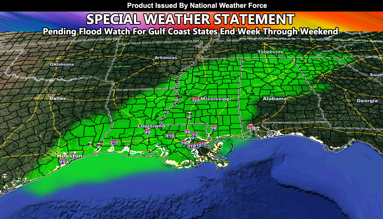
National Weather Force has issued a Special Weather Statement for the Gulf States from Houston to Atlanta through Louisiana, Mississippi, and Alabama effective the end of the week through the weekend as a tropical system is set to move through with flooding hazards so read on for details…
The tropical system is not expected to be overly strong like a hurricane as it looks to be rather wide. Whether it gets a closed circulation is beyond me, but if it does it can reach tropical depression/storm status before landfall. Landfall is projected to be somewhere near the TX/LA border regions or the Louisiana coast. Given how wide the system is with the strong low-level flow, this special weather statement will also contain a risk of tornadoes with it, mainly for areas Louisiana eastward.
The system will exit Georgia on Monday…
National Weather Force is pending a Flood Watch product for this region from Friday into the Weekend so await the final alert however you get them, on the FB page of the free e-mail alert system.
Want notifications? Sign into the free email alert system and choose your state area(s) -Southern California and Arizona are not served though.
LINK TO REGISTER IF ELSEWHERE – http://www.nationalweatherforce.com/national-weather-force-email-alert-system-sign-up/
Have a comment? Ask on the FB post – You can even ask your city and get an answer if you are confused – The NWF Facebook Page Link By Clicking Here

