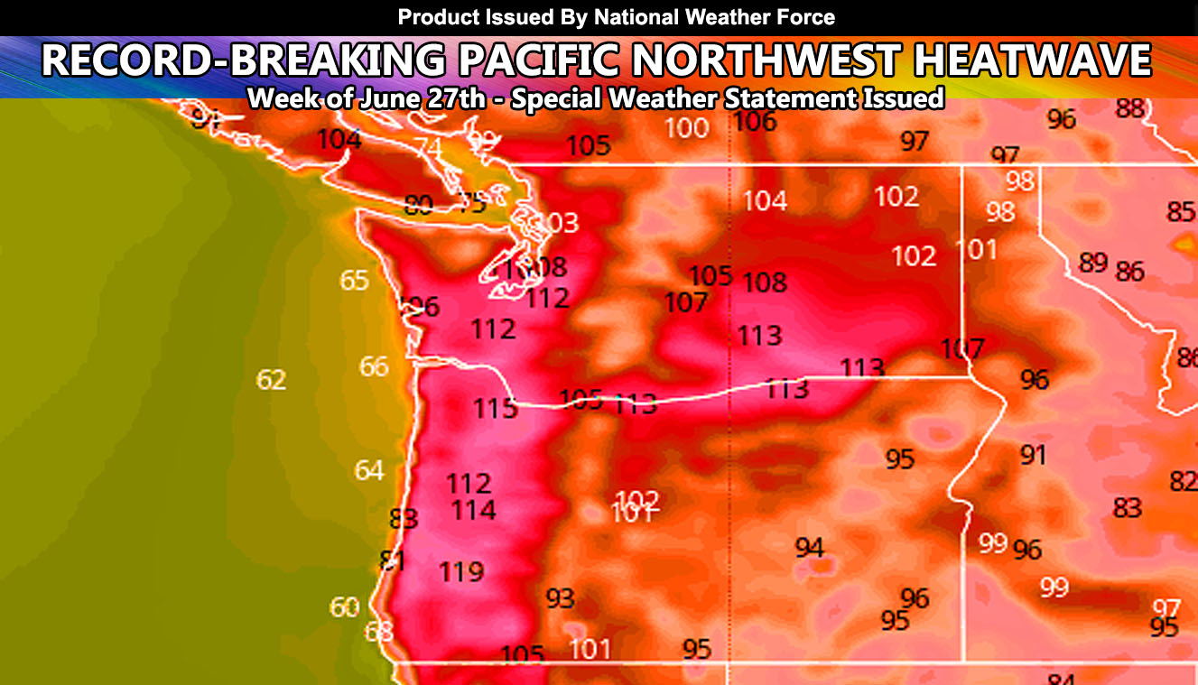
A record-breaking heatwave may be in the works starting this weekend and going through the early to mid part of the week of the 27th across the Pacific Northwest, Including the Willamette Valley to Seattle zones so read on for details …
A near 600m upper-level ridge of high pressure will form directly overhead by this weekend. This ridge is expected to be rather prolonged. A 600m ridge is extremely rare and has in the past challenged records at Death Valley as well. Height differences will draw wind west off the Cascade Mountains and cause compressional warming in the valley areas. This will boost the temperatures up in the Oregon/Washington Metros. High Pressure over the Washington Cascades will draw wind east towards Central/Eastern Washington and that is how you’ll get your heat there. This is an extremely rare event and will catch many off guard.
The heatwave will be less intense with mainly 90s in Central and Eastern Oregon (High Desert areas) –
I would suggest if you are in the projected areas in the map from this article above to prepare for this record-breaking heatwave coming up. This is the type to kill, especially if you are not used to it in the Pacific Northwest … Yes that is over 110+ in the Willamette Valley with some projecting even higher.\
Want notifications? Sign into the free email alert system and choose your state area(s) -Southern California and Arizona are not served though.
LINK TO REGISTER IF ELSEWHERE – http://www.nationalweatherforce.com/national-weather-force-email-alert-system-sign-up/
Have a comment? Ask on the FB post – You can even ask your city and get an answer if you are confused – The NWF Facebook Page Link By Clicking Here

