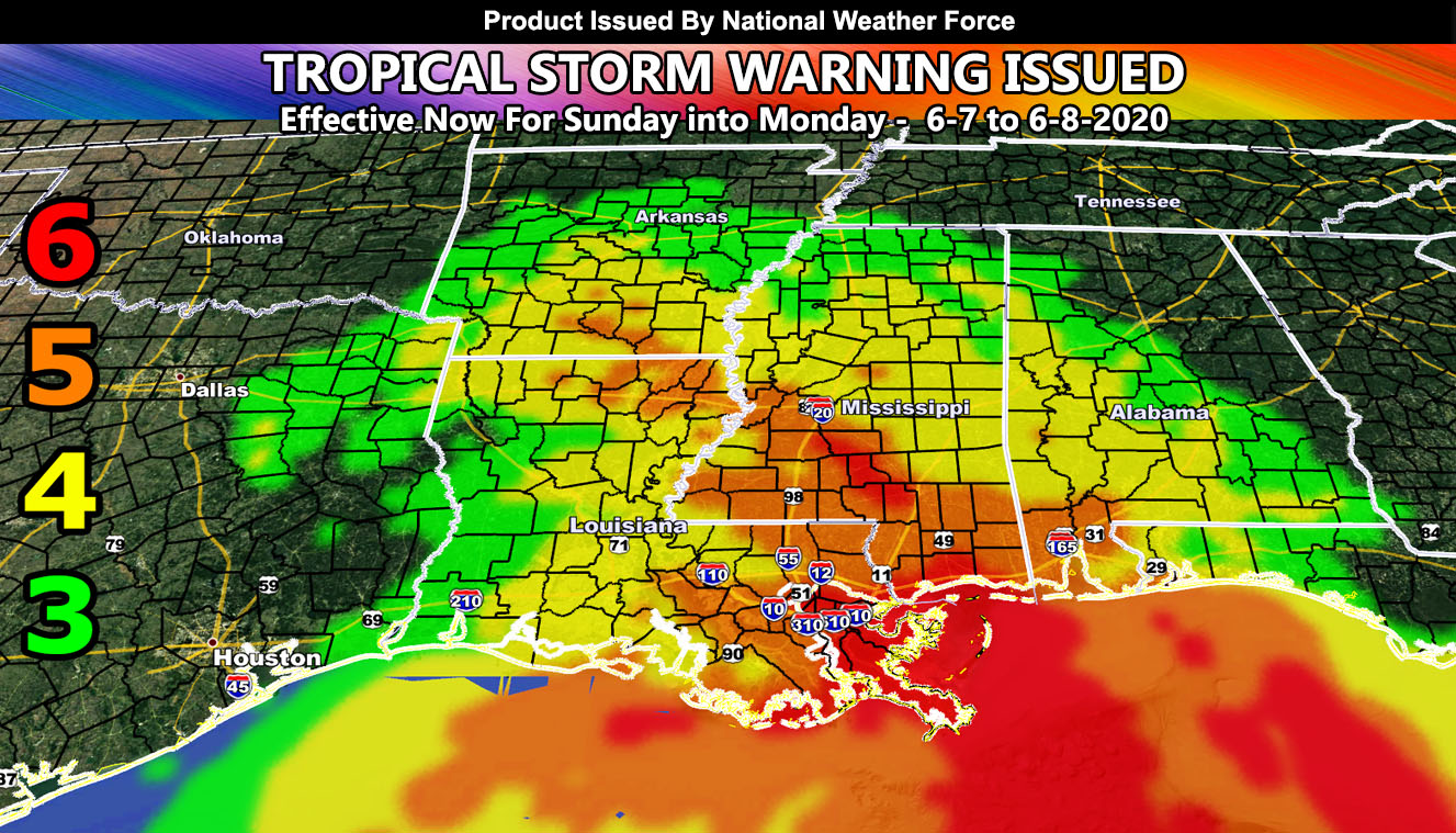
The National Weather Force has issued a TROPICAL STORM WARNING for Cristobal effective later this weekend into Monday for parts of Louisiana, Arkansas, Mississippi, and Alabama with an added Tornado Risk as well so read on for details …
The Tropical Storm Watch issued on June 1st has been replaced by this warning. The warning does remove Houston from any tropical storm force winds and the Martin Wind Gust Intensity Model is being used (article image) to show what kind of wind effects we will have. Keep in mind that the tropical storm force winds are wide and will arrive in New Orleans as early as later Saturday night, but by Sunday and Monday it will overspread the entire warning zone.
The above article image is for the following numbers below for wind effects –
6. SOME Trees are broken or uprooted, building damage is possible. – High Profile Vehicle Roll-Over Likely, Do NOT recommend Traveling in this zone
5. Slight damage occurs to buildings, shingles are blown off of roofs. HIGH WIND WARNING CRITERIA – High Profile Vehicle Roll-Over Possible if weight is not corrected.
4. Twigs and small branches are broken from trees, walking is difficult. Anything 4 and above will have blowing dust if conditions are dry, which does reduce visibility and make driving difficult …
3. Large trees sway, becoming difficult to walk.
WIND ADVISORY CRITERIA
With this will come a flood concern as well as a TORNADO RISK and here at National Weather Force … I will be ready to issue the appropriate tornado watches when warranted so stay tuned …
Follow National Weather Force on Facebook. The page posts ONLY to targeted state news-feeds so you only see what matters in your state! –
Click here to follow/like today!
National Weather Force is a custom and full weather alert office that handles moderate to high impact weather events and issues weather alerts for flood, snow, tornado, hurricane, and ice events. You may not see what this page/site has elsewhere as it is all done custom with no relay from outside sources.
