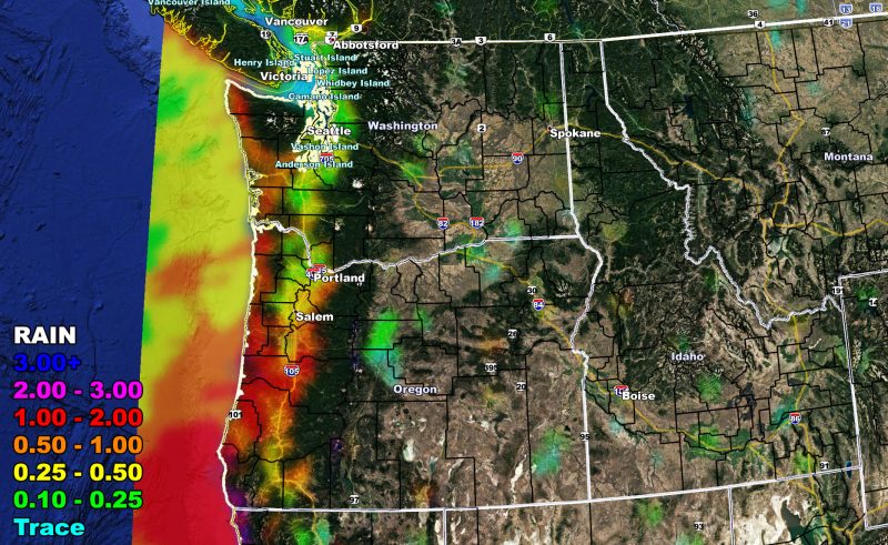
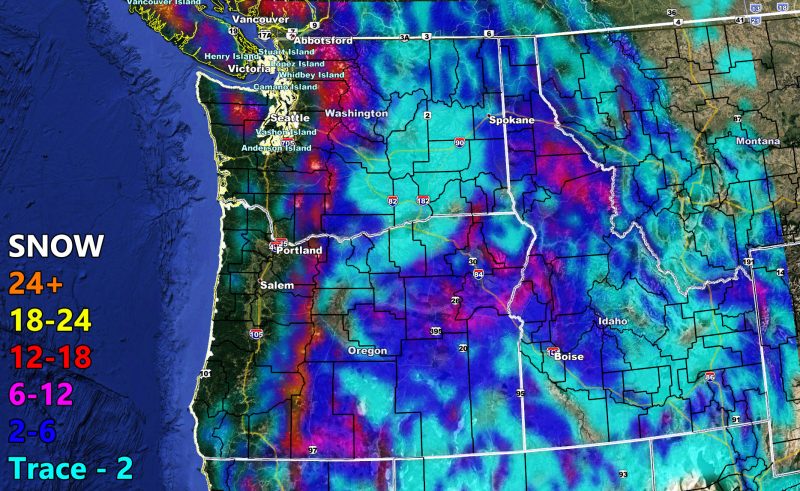
A winter storm moving through the Pacific Northwest, which started this morning, will move eastward and provide snowfall for Eastern WA/OR and all of Idaho. The maps within this discussion are clickable for a larger image on what to expect now through Friday evening.
The NWF model image suite below is so you can see your zone region covered. Keep in mind that these are the most comprehensive images around. They are touchy to the micro-climate and in the rain and flood risk model, you will only see the expected risk or amount. Those models actually cancel out the snow so before you saw flood risks covering the mountains. The new models remove that and make it easier to know what to expect.
Want notifications? Sign into the free email alert system and choose your state area(s) -Southern California and Arizona are not served though.
LINK TO REGISTER IF ELSEWHERE – http://www.nationalweatherforce.com/national-weather-force-email-alert-system-sign-up/
Have a comment? Ask on the FB post – You can even ask your city and get an answer if you are confused – –
Rain and Snow Forecast Maps For WA/OR/ID Valid Now Through Friday Evening
A winter storm moving through the Pacific…
Posted by National Weather Force on Thursday, February 18, 2021


