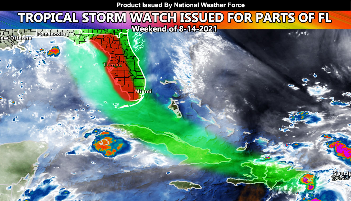
National Weather Force has issued a Tropical Storm Watch for parts of Florida mainly the western half of the peninsula. Other areas within Florida will have a Flood Watch attached to the warning when it is issued, along with flood risk maps from the NWF Flood Risk Model. Conditions are becoming favorable for Tropical Storm conditions in or around the watch area from August 14th through the 15th. Wind gusts between 40-50 mph will be possible with this system. It is not a particularly strong system so not much really can be said about it. It is fighting the mountains of Haiti and the Dominican Republic, next onto Northern Cuba. All this is going to keep Fred a the storm status.
Within the map included in this write-up, the green cone is the cone of uncertainty in different landfall points. The red-shaded area in Western Florida’s Peninsula is the official NWF Tropical Storm Watch zone. The entire state of FL minus most of the panhandle will see a flood issue with Fred. Additional updates will be given over the e-mail alert system as the weekend approaches.

