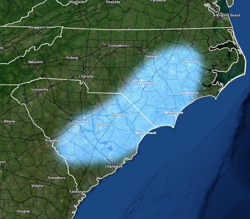
Alert Type: Ice Storm Watch
Issued or Partial Issued States: SC, NC
Site: National Weather Force has issued a Ice Storm Watch effective for Friday evening through Saturday, January 21-22, 2022
Date Issued: 1/18/22 at 7:40 pm Eastern
Forecast: A system moving through Arizona right now will eject into the plains on Wednesday and produce severe weather with the risk of tornadoes for MS/LA during the evening/night hours, with flooding east into AL. This same system will move eastward toward the Carolinas on Friday and eventually the already freezing temperatures in place that day will hit the moisture coming in from the south, thus making ice very likely. There is a good chance of high risk conditions in the watch area.
A NWF Ice Storm Watch means conditions are favorable for more than 0.25″ of ice within the watch area. This watch means that a warning will be monitored to be issued for this event, but does give you lead-time to know what is coming so you can prepare. If in the watch area, do you ice storm preparations now … Falling branches and loss of power will be highly likely –

