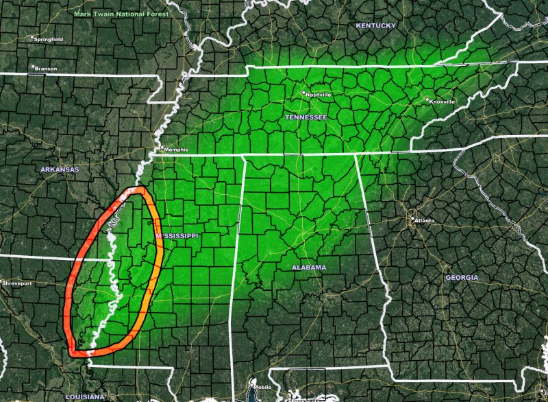
Issued or Partial Issued States: LA, MS, AL, TN
Site: National Weather Force has issued a Flood Watch effective for Wednesday evening until Thursday morning, January 19-20, 2022
Date Issued: 1/18/22 at 10:00 am Central
Forecast: A system moving through Arizona right now will ejected into the plains on Wednesday. Upper level jet dynamics favor heavy rainfall developing across Arkansas and moving eastward with time Wednesday evening through the overnight into Thursday morning across the watch area. Rainfall rates will be enough at times to exceed flash flood warning criteria in the strongest cells.
Thunderstorms will be reserved for where the stronger instability resides, Mississippi and Louisiana.
There is a tornado risk in the red-outlined area of the watch. Now, the outline is not the only risk, the risk will extend beyond the watch southwest through Louisiana and into Southeast Texas. Because those are not in the flood watch, the outline does not reflect it (red-outlined zone). I’ll need additional forecast for the tornado risks.
A NWF Flood Watch is issued when conditions are favorable for high rainfall rates in a short period of time that can lead to flooding, be it a regional area or along a strong cold front.

