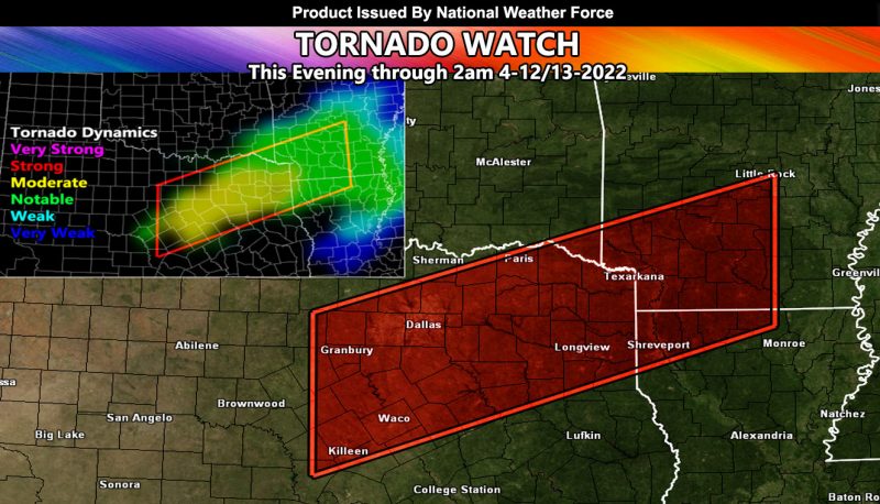
Issued or Partial Issued States: TX, AR, LA – Map inside shows affected state areas.
Site: National Weather Force has issued a Tornado Watch effective now through 2am tomorrow morning …
Date: 4/12/22 at 12:55pm Central Time
Forecast: An upper level low will eject into Texas from the Pacific Southwest today. While this is creating high fire hazards across the western part of the state, the backing southeast flow is bringing in strong moisture returns in the watch area. This will bring instability parameters into the 2,000 j k/g mark, which is more than enough for explosive development. Storms are expected to form west of Dallas and south from there as well …
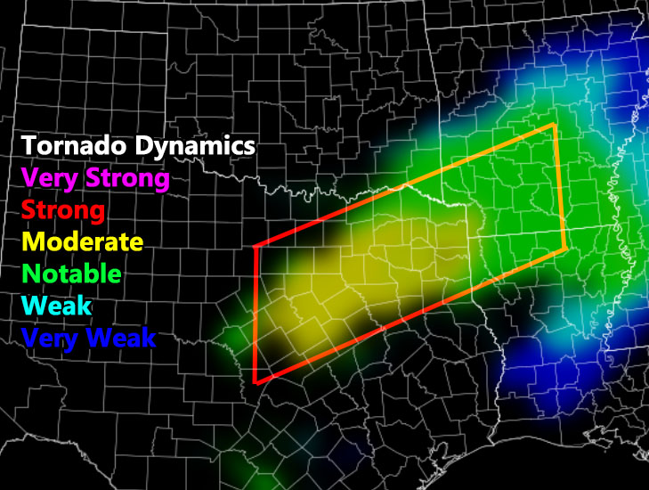
The best areas seems to be the western half of the watch box, with lesser (but not zero) dynamics for the eastern half as noted in the NWF Tornado Risk Analysis Model below this write-up … Storms will form in Texas and move into parts of AR/LA with time … I cannot rule out a strong tornado with it as a moderate shade is considered EF2+ being possible –
In addition to the tornado watch, large hail and damaging winds will be likely with the storms … the highest winds in TX
HOW TO GET THESE ALERTS?.
SIGN-UP TO THE FREE NWF E-MAIL ALERT SYSTEM FOR YOUR AREA HERE WHERE YOU PICK YOUR AREA IN YOUR OWN CONTROL PANEL BY STATE LOCATION AND GET NOTIFIED WHEN A POST IS MADE FOR YOU https://www.nationalweatherforce.com/national-weather-force-email-alert-system-sign-up/
FOLLOW the Facebook Page after reading this and interact with the post made about this, whether sharing, liking, or commenting … It will be answered
CLICK HERE TO FOLLOW THE MAIN FACEBOOK PAGE


