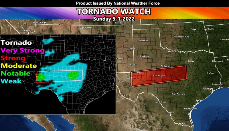
Issued or Partial Issued States: TX – Map inside shows affected state areas.
Site: National Weather Force has issued a Tornado Watch effective today …
Date: 5/1/22 at 12:40pm Central Time
Forecast: Instability developing to over 2,000 j k/g will be the trigger for explosive thunderstorms across Western Texas today. These storms will form on the NM/TX border southward through the US/Mexico Border. They will move eastward with time and with a southeast backing surface wind, this + the shear will bring the notable tornado watch in and around the watch area.
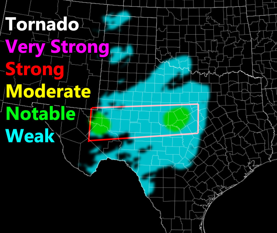
I do not see a strong enough value on the National Weather Force Tornado Risk Model for further north in areas like the Panhandle of Texas, but it does show ‘weak’ dynamics there for spin-ups.
The notable, but not fully powerful dynamics will exist around the Pecos and Crane County areas, eastward through San Angelo, ending just before or at the Waco forecast area.
This could bring very weak tornado dynamics through DFW way later on overnight into Monday morning, but that’s about all I expect, and no additional tornado watches will be needed.
HOW TO GET THESE ALERTS?.
SIGN-UP TO THE FREE NWF E-MAIL ALERT SYSTEM FOR YOUR AREA HERE WHERE YOU PICK YOUR AREA IN YOUR OWN CONTROL PANEL BY STATE LOCATION AND GET NOTIFIED WHEN A POST IS MADE FOR YOU https://www.nationalweatherforce.com/national-weather-force-email-alert-system-sign-up/
FOLLOW the Facebook Page after reading this and interact with the post made about this, whether sharing, liking, or commenting … It will be answered
CLICK HERE TO FOLLOW THE MAIN FACEBOOK PAGE


