
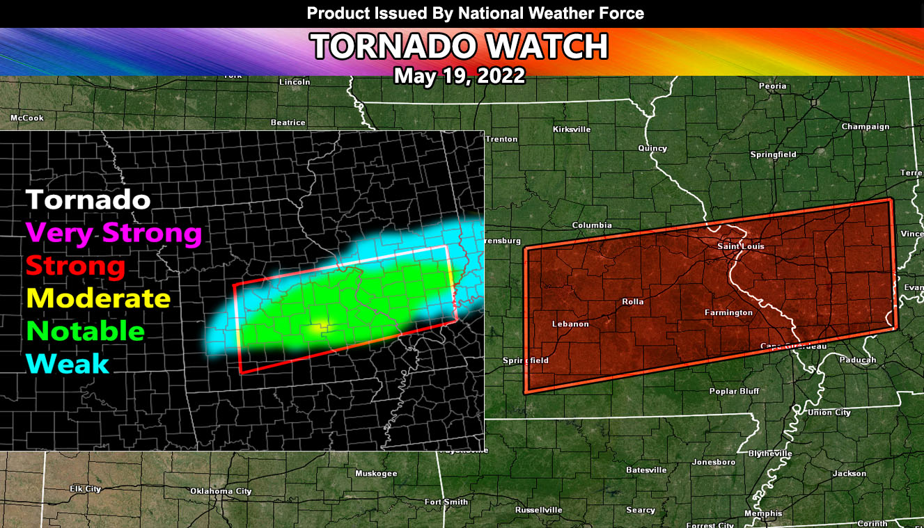
Issued or Partial Issued States: MO, IL – Map inside shows affected state areas.
Site: National Weather Force has issued a Tornado Watch effective now through 10pm CDT tonight … May 19-2022
Date: 5/19/22 at 11:20am Central Time
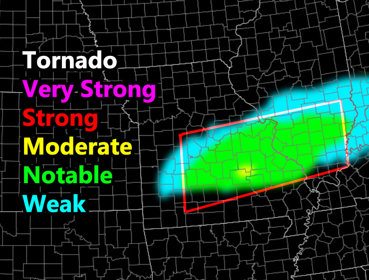
Forecast: A small scale system called an MCV; or Mesoscale Convective Vort, will move across the Southern half of Missouri and into Illinois this afternoon/evening, and this will bring a corridor of surface instability to the watch area. This, with developing low-level shear will make tornadoes possible.
Given the instability/shear values, notable tornado dynamics will be in the area, enough for a low-grade watch for up to EF1-2 tornadoes, but, I do see on my model a small area of moderate, thus we could have an isolated strong tornado in this watch.
In addition to the tornado risk, large hail and damaging winds will be likely …
A NWF Tornado Watch is issued when notable tornado dynamics exist. Weaker spin-ups can happen in the ‘weak’ category, but boxes for that are usually not issued, therefore the box will only cover the notable dynamics in the model below …
HOW TO GET THESE ALERTS?.
SIGN-UP TO THE FREE NWF E-MAIL ALERT SYSTEM FOR YOUR AREA HERE WHERE YOU PICK YOUR AREA IN YOUR OWN CONTROL PANEL BY STATE LOCATION AND GET NOTIFIED WHEN A POST IS MADE FOR YOU https://www.nationalweatherforce.com/national-weather-force-email-alert-system-sign-up/
FOLLOW the Facebook Page after reading this and interact with the post made about this, whether sharing, liking, or commenting … It will be answered
CLICK HERE TO FOLLOW THE MAIN FACEBOOK PAGE