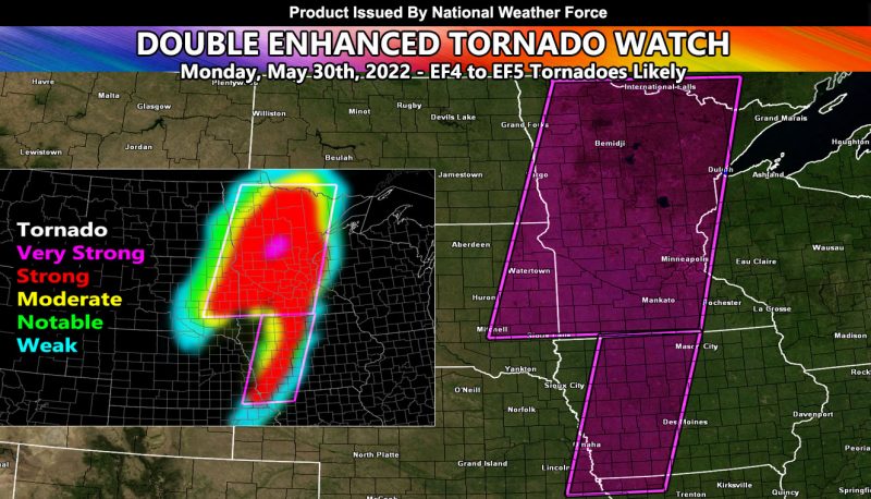
Issued or Partial Issued States: MN, IA, SD, ND – Map inside shows affected state areas.
Site: National Weather Force has issued an Enhanced Tornado Watch effective now through midnight central … THIS IS A DANGEROUS SITUATION THAT HAS THE DYNAMICS TO PRODUCE VIOLENT TORNADOES, INCLUDING EF4 TO EVEN EF5, ESPECIALLY ACROSS MINNESOTA …
Date: 5/30/22 at 12:00pm Central Time
Forecast: An upper level low has ejected into the Northern Plains. This has developed a strong surface low (sub 980mb) that will move across Western Minnesota, providing the backing southeast surface winds into the supercells. At the jet stream level, over a 120 kt core from south to north will provide extremely high shear values.
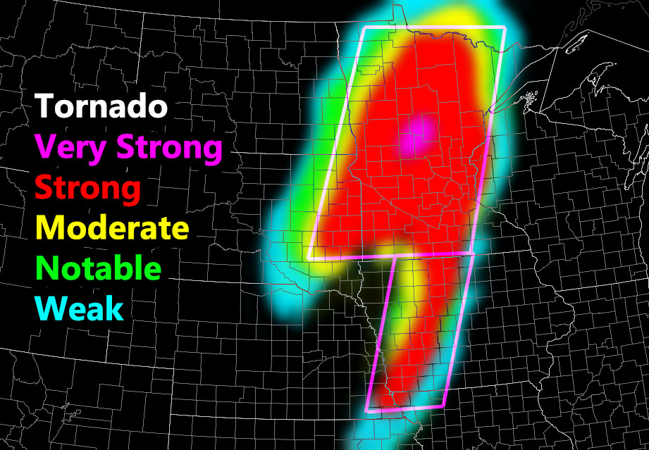
The graphic above shows the magenta watch area. This magenta area is where the most violent tornado dynamics will be and the good chance of a strong/violent tornado of EF3 or stronger … but in reality my model is prediction and EF4 or higher with this event.
In addition to the tornadoes, very large hail and damaging winds will accompany the entire watch area …
HOW TO GET THESE ALERTS?.
SIGN-UP TO THE FREE NWF E-MAIL ALERT SYSTEM FOR YOUR AREA HERE WHERE YOU PICK YOUR AREA IN YOUR OWN CONTROL PANEL BY STATE LOCATION AND GET NOTIFIED WHEN A POST IS MADE FOR YOU https://www.nationalweatherforce.com/national-weather-force-email-alert-system-sign-up/
FOLLOW the Facebook Page after reading this and interact with the post made about this, whether sharing, liking, or commenting … It will be answered


