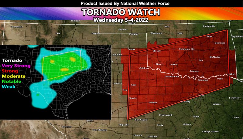
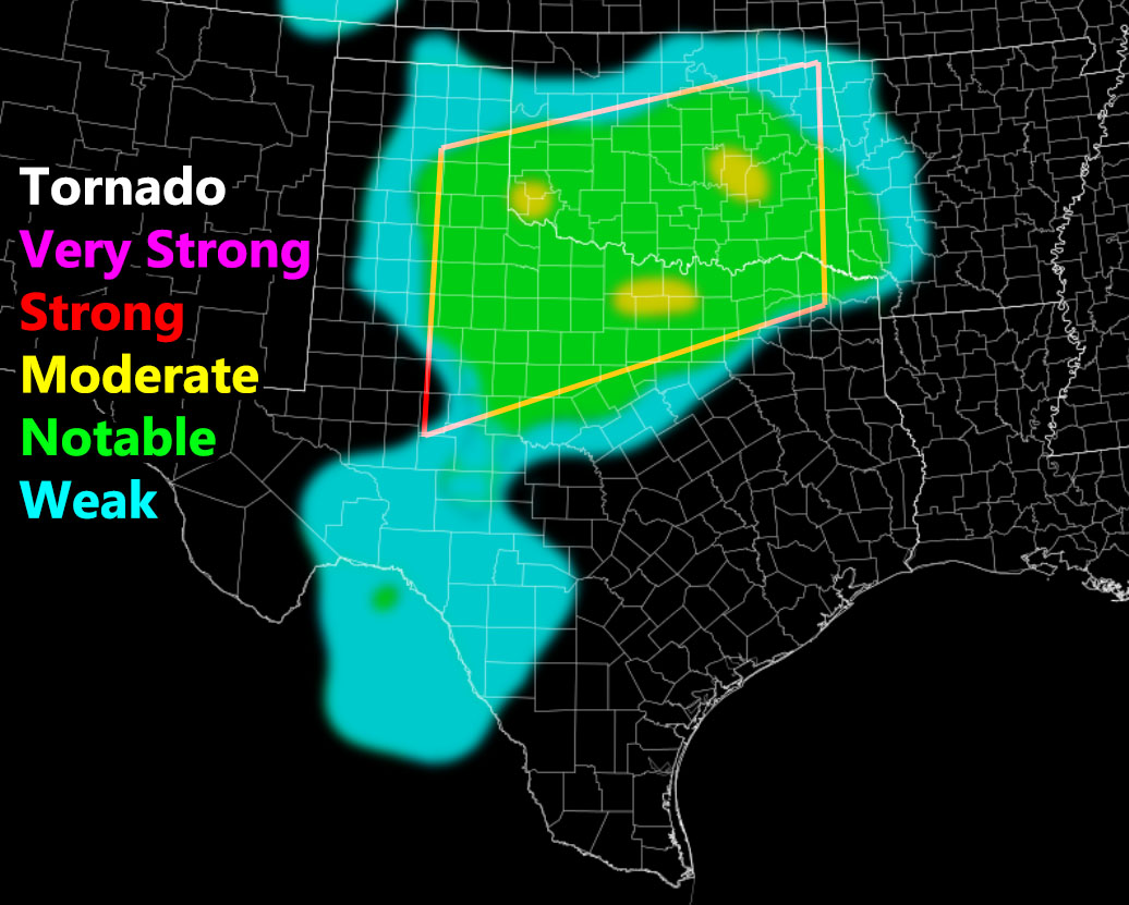
Issued or Partial Issued States: TX, OK – Map inside shows affected state areas.
Site: National Weather Force has issued a Tornado Watch effective today, May, 4, 2022 …
Date: 5/4/22 at 11:50am Central Time
Forecast: A surface low currently in Southeastern Colorado will move into the Texas Panhandle this afternoon. At the surface, dewpoints in the upper 60s and even 70s will be in the forecast. Temperatures this afternoon/evening at or near 80. This will push instability values between 2000-3000 j k/g, which is more than enough for explosive severe thunderstorms. Areas in the target zone of the Childress, TX and Altus, OK forecast areas will see values as high as 4000 j k.g.
These main storm focus should start around the Texas Panhandle and move east with time into Oklahoma.
Areas within it should prepare for tornadoes, strong at times, very large hail, and damaging winds in excess of 70+ mph. You also have back-to-back waves of activity moving through all night, which will bring a significant flood risk.
HOW TO GET THESE ALERTS?.
SIGN-UP TO THE FREE NWF E-MAIL ALERT SYSTEM FOR YOUR AREA HERE WHERE YOU PICK YOUR AREA IN YOUR OWN CONTROL PANEL BY STATE LOCATION AND GET NOTIFIED WHEN A POST IS MADE FOR YOU https://www.nationalweatherforce.com/national-weather-force-email-alert-system-sign-up/
FOLLOW the Facebook Page after reading this and interact with the post made about this, whether sharing, liking, or commenting … It will be answered


