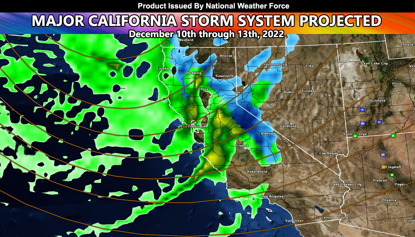
A major storm system will impact the state of California this weekend, lasting through some of Monday as well. This system will have a weaker front crossing Central/Northern California on Thursday before a major impact on Friday night and mostly into Saturday and Sunday. What I see now is 4+ foot snow amounts for the Sierra Nevada Mountains, including the Mammoth areas. Bishop will have 2-4″ of snow as well.
Given multiple storm fronts, areas like San Francisco through the Sacramento forecast zones will have 2-4″ of rainfall, and yes this is a flood scenario. Not much else to talk about, but you should prepare for this system as it will be the strongest one of the winter season thus far.
If you are in Southern California, your storm pattern article is at Southern California Weather Force and can be viewed by Clicking Here
SIGN-UP TO THE FREE NWF E-MAIL ALERT SYSTEM FOR YOUR AREA HERE WHERE YOU PICK YOUR AREA IN YOUR OWN CONTROL PANEL BY STATE LOCATION AND GET NOTIFIED WHEN A POST IS MADE FOR YOU https://www.nationalweatherforce.com/national-weather-force-email-alert-system-sign-up/
FOLLOW the Facebook Page after reading this and interact with the post made about this, whether sharing, liking, or commenting … It will be answered
CLICK HERE TO FOLLOW THE MAIN FACEBOOK PAGE

