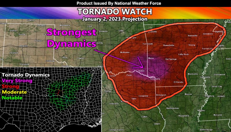
Issued or Partial Issued States: TX, OK, LA, AR – Map inside shows affected state areas.
Site: National Weather Force has issued a Tornado Watch effective now through midnight local time tonight …
Date: 1/2/23 at 10:30am Central Time
Forecast: An upper level low will eject into Texas from the Pacific Southwest today. This system will draw in gulf moisture and bring a frontal zone across Eastern Texas this afternoon/evening, spreading throughout the period to the east, covering Oklahoma/Arkansas/Louisiana.
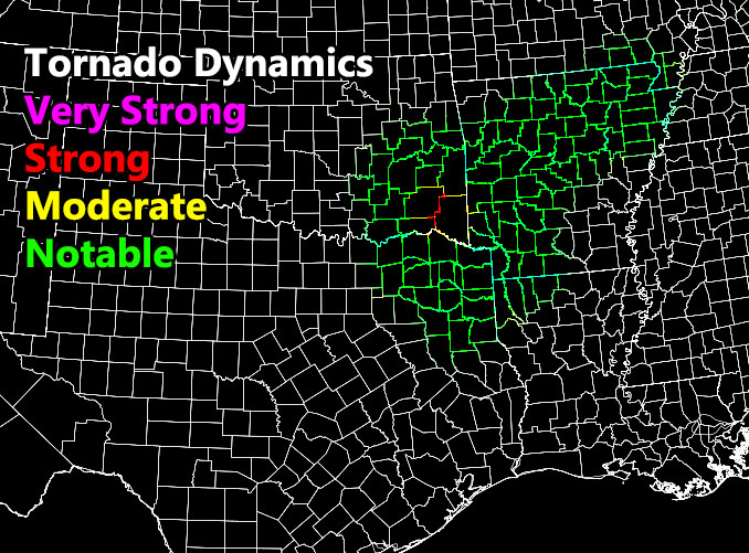
Strong instability and strong low-level shear will promote the tornado risk across the Tornado Watch zone. The strongest dynamics will be sometime later this evening across an area surrounding McCurtain County, Oklahoma, or the most extreme southeast county in the state. This is where the National Weather Force Tornado Risk Model shows the strongest dynamics to be. The rest of the watch area can see up to EF1 tornado chances through the watch period.
Because the upper-level system will be mostly linear along the front than non-linear, the tornado risk does not affect a very large area.
In addition to the Tornado Watch, damaging winds, large hail, and flooding will be other factors …
Below is the National Weather Force Tornado Model for this event.
HOW TO GET THESE ALERTS?.
SIGN-UP TO THE FREE NWF E-MAIL ALERT SYSTEM FOR YOUR AREA HERE WHERE YOU PICK YOUR AREA IN YOUR OWN CONTROL PANEL BY STATE LOCATION AND GET NOTIFIED WHEN A POST IS MADE FOR YOU https://www.nationalweatherforce.com/national-weather-force-email-alert-system-sign-up/
FOLLOW the Facebook Page after reading this and interact with the post made about this, whether sharing, liking, or commenting … It will be answered
CLICK HERE TO FOLLOW THE MAIN FACEBOOK PAGE


