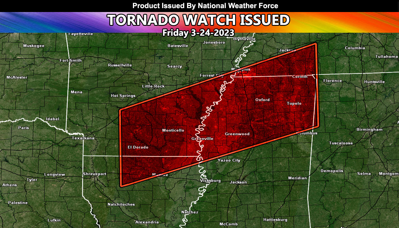
National Weather Force has issued a Tornado Watch for strong tornado dynamics effective now through midnight tonight local time for Parts of Arkansas, Louisiana, Mississippi, and Tennessee.
An upper-level low will eject into Arkansas from the Pacific Southwest this evening. This system will draw in gulf moisture and bring a frontal zone across Southern Arkansas into Northern Louisiana Texas this evening, spreading throughout the period to the east tonight.
Lifting ahead of the cold front will maximize the strong tornado potential with any discrete for Southeastern Arkansas and the Northern half of Mississippi tonight. This is where the National Weather Force Tornado Risk Model shows the strongest dynamics to be. Tornadoes stronger than EF3 are possible with such a setup.
In addition to the Tornado Watch, damaging winds, large hail, and flooding will be other factors …

