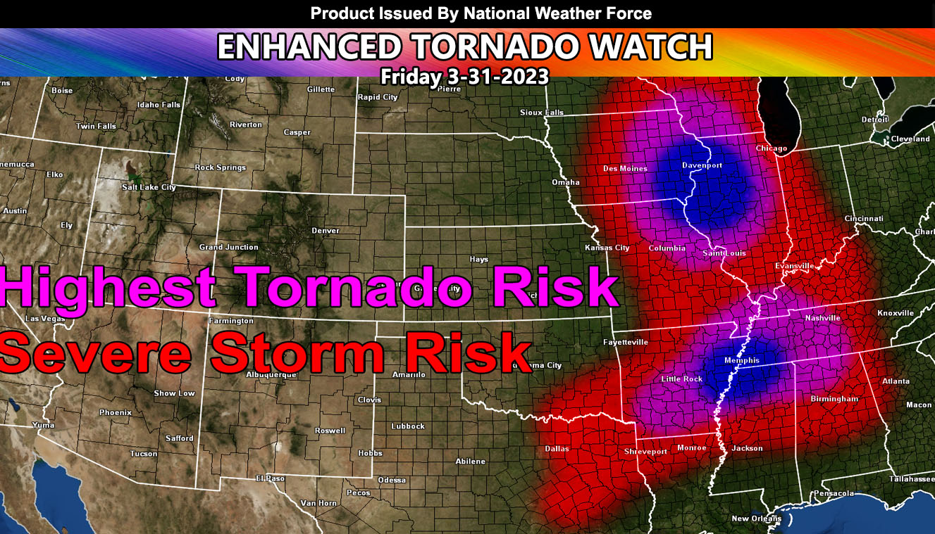
National Weather Force is predicting a tornado outbreak that will be for the following states; Iowa, Illinois, Indiana, Kentucky, Tennessee, Alabama, Mississippi, Arkansas, and Texas. This will be the first major severe weather outbreak of the season, which will be a very active tornado season in Tornado Alley so read on for details …
A strong upper-level low moving across the Southwestern United States now will eventually move into the Central United States. This will happen Today , March 31, 2023. The system will have two parts to it, one in the Iowa, Illinois, bordering forecast areas, the other being in the Arkansas, Mississippi, and Tennessee forecast areas. The northern focus spot will be nearest both the upper-level low and the surface low. This is where we will find the strongest tornado activity. With instability values of 3000 j/kg and shear values over 300 m/s2, we are looking at the real chance of EF3 or higher tornadoes in this zone.
Further south, we are seeing the cold front, where storms forming along it will have a uni-directional upper-level flow and still have the power to produce tornadoes, some strong. I do think that both zones will produce a major severe weather event like the map above states.
National Weather Force will be finalizing this event with this high-risk tornado watch…
HERE IS THE ARTICLE FROM YESTERDAY THAT SHOWED WE WERE CORRECT …
HOW TO GET THESE ALERTS?.
SIGN-UP TO THE FREE NWF E-MAIL ALERT SYSTEM FOR YOUR AREA HERE WHERE YOU PICK YOUR AREA IN YOUR OWN CONTROL PANEL BY STATE LOCATION AND GET NOTIFIED WHEN A POST IS MADE FOR YOU https://www.nationalweatherforce.com/national-weather-force-email-alert-system-sign-up/
FOLLOW the Facebook Page after reading this and interact with the post made about this, whether sharing, liking, or commenting … It will be answered.
CLICK HERE TO FOLLOW THE MAIN FACEBOOK PAGE

