
National Weather Force has issued a Super Long-Range Weather Watch effective now through April 2023 as long-range pattern assessment suggests that we are not close to done yet this season and that storm after storm will continue for at least the next 40 days so read on for details …
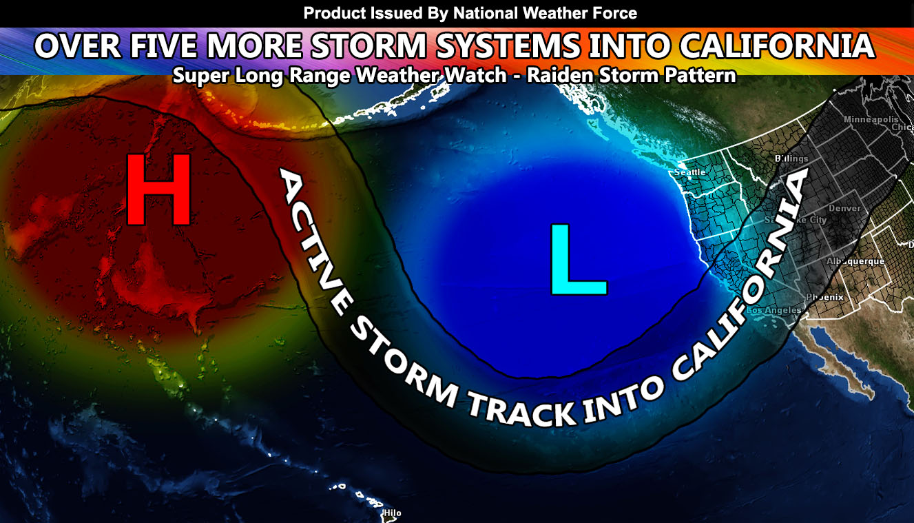
Pattern assessment over the last few days has indicated that a ridge over the Aleutian Islands of Alaska will work with a static low north of Hawaii and another west of Northern California. This end result would be the polar and tropical jet will remain working together and bring storm after storm into California, separated by a few days at times, and 7-10 days at other times.
There is a very high percentage likelihood that storms will continue through April with several impacting the state, adding onto the already deep snowpack in the upper Sierra Nevada and the flooding rains across the lower terrain.
Systems in this would bring a combination of higher snow levels along with crashing lower snow-levels behind the fronts. This again will continue to make avalanche and rockslide dangers across all mountain areas, and coastal/hillside erosion in areas already not taking it anymore. If your house is in an eroded zone or at risk of a landslide, you must find a way to prepare now because the coming pattern will continue to be the same as what we have been seeing this season.
In addition to the rain and snow, the sun angle is getting higher, and we have seen tornadic storms in the state as a result with the recent storm systems this month. As we continue to grow into Spring, the combination of the low-level heating and cold air aloft coming in with the storms (along with the upper-level jet stream) will increase the thunderstorm risks across the state, including severe thunderstorms, hail, damaging winds, and even more tornadoes.
The best times for drier conditions will be toward the first week of April and then again toward the end of the month then. The stormiest periods would be a back-to-back storm pattern with multiple systems into the state after April 10th and going on for a couple weeks thereafter.
We are at 25″ of rainfall for Los Angeles at the moment. The record is 37″ set back in the 2004-2005 season.
That is your Super Long Range Weather Watch. As we get closer to the events, Long Range Weather Advisories or Warnings will go out on an upgraded alert. Stay tuned to National Weather Force for updates as we near each pattern to come in what will be yet another Raiden Storm Pattern as this will be the first scientific write-up on April’s pattern, which is not normally a stormy month … but this season has been anything but ‘normal’ in a sense.
HOW TO GET THESE ALERTS?.
SIGN-UP TO THE FREE NWF E-MAIL ALERT SYSTEM FOR YOUR AREA HERE WHERE YOU PICK YOUR AREA IN YOUR OWN CONTROL PANEL BY STATE LOCATION AND GET NOTIFIED WHEN A POST IS MADE FOR YOU https://www.nationalweatherforce.com/national-weather-force-email-alert-system-sign-up/
FOLLOW the Facebook Page after reading this and interact with the post made about this, whether sharing, liking, or commenting … It will be answered.
CLICK HERE TO FOLLOW THE MAIN FACEBOOK PAGE