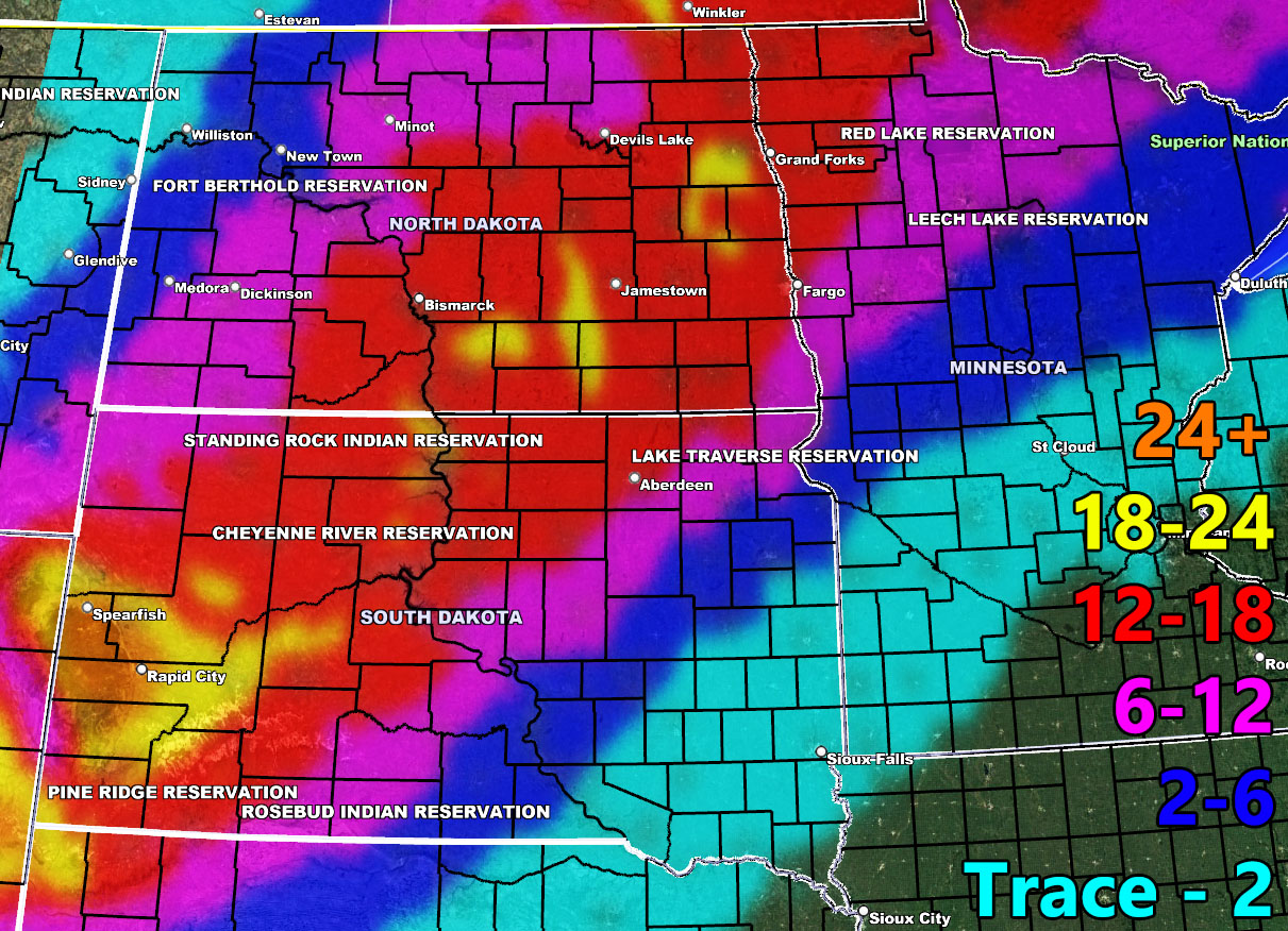
National Weather Force has issued a Blizzard Warning effective Tuesday into Wednesday, April 4-5, 2023, for parts of South Dakota, most of North Dakota, and into Northwest Minnesota so read on for details … The map above is snowfall amount predicted in inches.
A strong surface low that will create a tornado outbreak well east of the warning area will move through tonight and into Tuesday. This southwest to northeast movement will deepen the surface low as it moves through the warning areas and create strong 50+ mph wind gusts. In addition to this, heavy snow on the order of 12-18″ will cause white-out conditions and travel is not recommended during this period.
Additional gusts into Wednesday with a loss of the snowfall will continue blizzard conditions as blowing snow.
HOW TO GET THESE ALERTS?.
SIGN-UP TO THE FREE NWF E-MAIL ALERT SYSTEM FOR YOUR AREA HERE WHERE YOU PICK YOUR AREA IN YOUR OWN CONTROL PANEL BY STATE LOCATION AND GET NOTIFIED WHEN A POST IS MADE FOR YOU https://www.nationalweatherforce.com/national-weather-force-email-alert-system-sign-up/
FOLLOW the Facebook Page after reading this and interact with the post made about this, whether sharing, liking, or commenting … It will be answered.
CLICK HERE TO FOLLOW THE MAIN FACEBOOK PAGE

