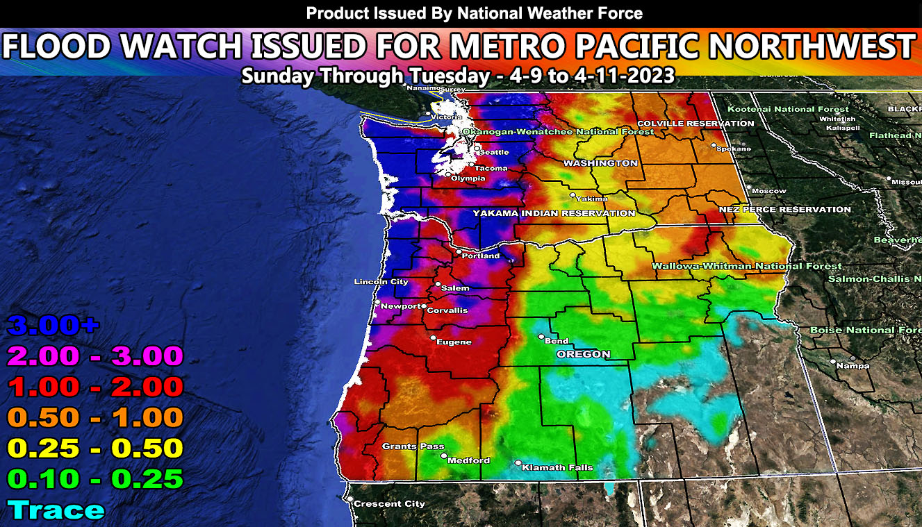
National Weather Force has issued a Flood Watch effective Sunday April 9th through Tuesday April 11th with a series of storm fronts moving through the Pacific Northwest. The jet stream has moved north, pretty much on track for this time of year. Heavy rainfall will hit Sunday through Tuesday.
Areas along the Washington and Oregon Coastal and Foothill Zones below the snow-levels will see well over 3+” of rainfall with the combined passage of the frontal zones. Areas along I-5 from Seattle through Portland, and further south through Salem and Eugene will see 2+ inches of rainfall.
THUNDERSTORMS: Tuesday is when the convective part of the system comes in. Upper-level divergence (lift) will be strong enough to warrant the chance of thunderstorms in the watch areas. Another weak front will hit on Thursday, but then after that the area will dry out until the next hit on or around April 17th.
HOW TO GET THESE ALERTS?.
SIGN-UP TO THE FREE NWF E-MAIL ALERT SYSTEM FOR YOUR AREA HERE WHERE YOU PICK YOUR AREA IN YOUR OWN CONTROL PANEL BY STATE LOCATION AND GET NOTIFIED WHEN A POST IS MADE FOR YOU https://www.nationalweatherforce.com/national-weather-force-email-alert-system-sign-up/
FOLLOW the Facebook Page after reading this and interact with the post made about this, whether sharing, liking, or commenting … It will be answered.
CLICK HERE TO FOLLOW THE MAIN FACEBOOK PAGE

