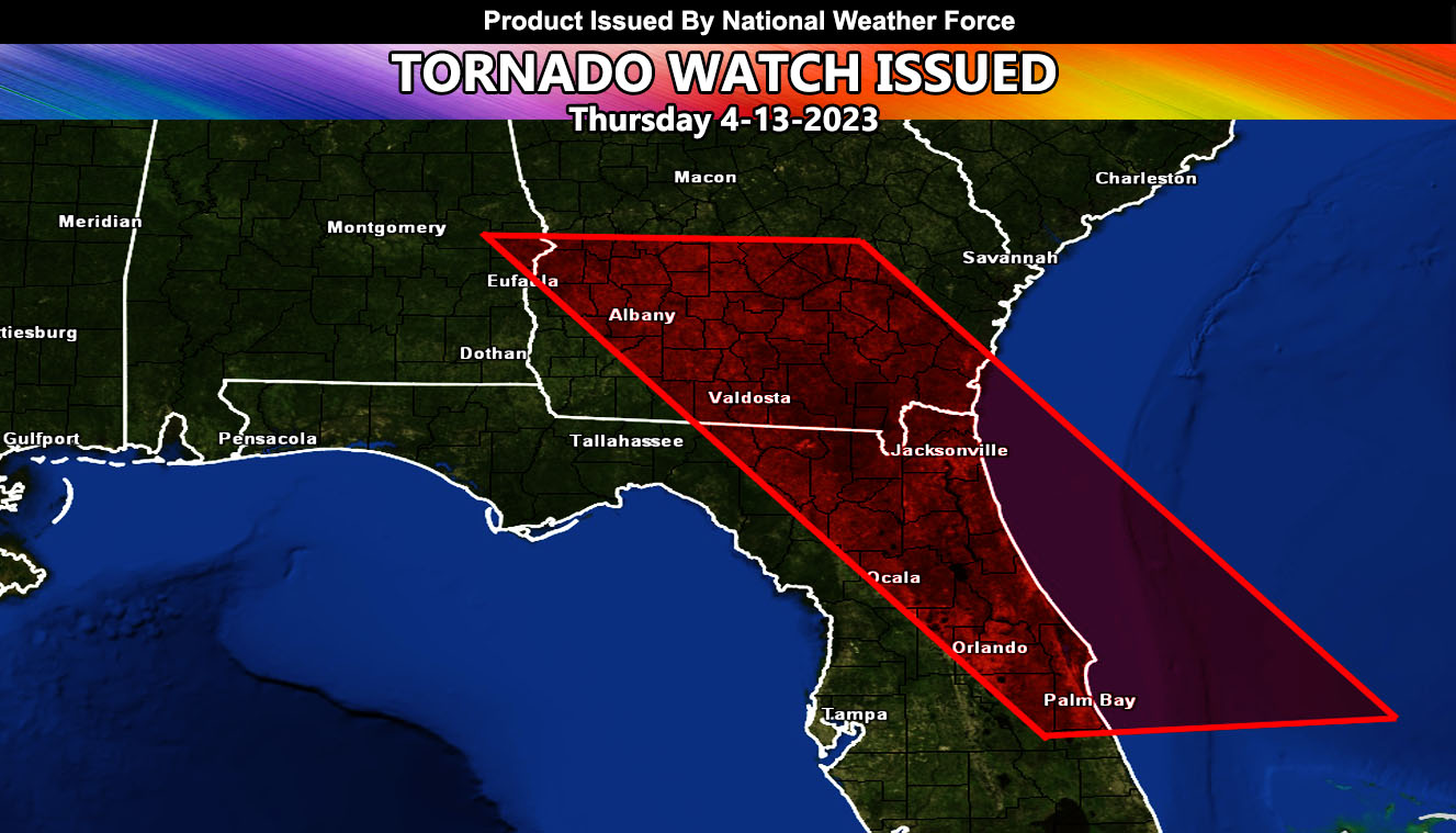
National Weather Force has issued a Tornado Watch effective now through midnight eastern time, Thursday April 13, 2023.
A surface low moving into the Alabama zones will bring in a strong southeast wind at the surface. This, with strong instability developing along a spiral band on the eastern periphery of the system, will bring the chance of severe thunderstorms in and around the watch area. Tornado dynamics do not seem to be too strong, but up to EF1 will be possible with any of the storms along the expected arc that will move through.
The main focus spots would seem to be the Georgia section; however, I do think the stronger dynamics will be along the Seabreeze boundary from the Cape Canaveral, FL zones north along the coast to the Jacksonville, FL forecast area.
In addition to the tornado risk… large hail and damaging winds will accompany the stronger storms.
Storms will move north out of the region by midnight eastern time, ending the watch.
HOW TO GET THESE ALERTS?.
SIGN-UP TO THE FREE NWF E-MAIL ALERT SYSTEM FOR YOUR AREA HERE WHERE YOU PICK YOUR AREA IN YOUR OWN CONTROL PANEL BY STATE LOCATION AND GET NOTIFIED WHEN A POST IS MADE FOR YOU https://www.nationalweatherforce.com/national-weather-force-email-alert-system-sign-up/
FOLLOW the Facebook Page after reading this and interact with the post made about this, whether sharing, liking, or commenting … It will be answered.
CLICK HERE TO FOLLOW THE MAIN FACEBOOK PAGE

