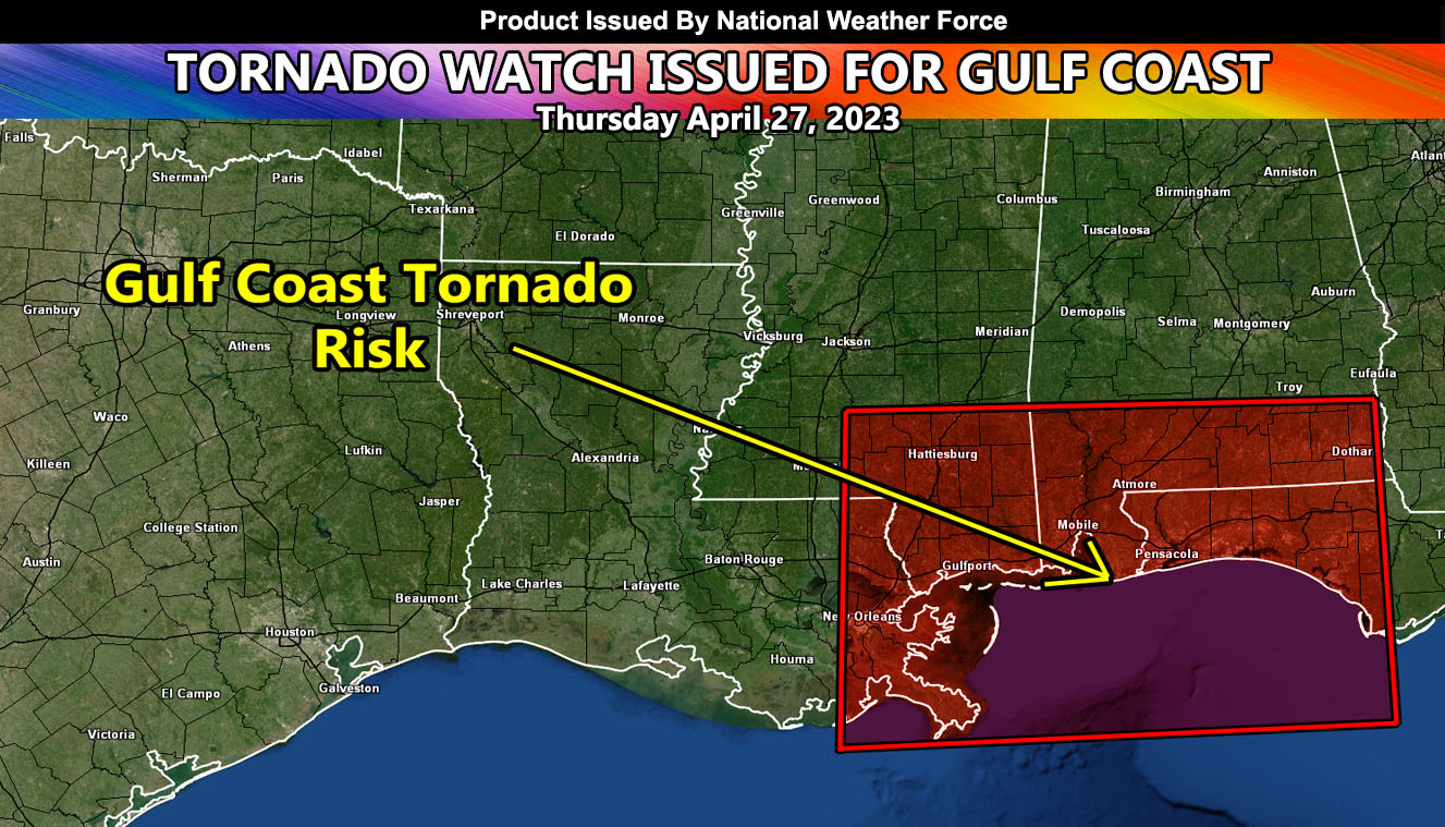
National Weather Force has issued a Tornado Watch for Eastern Louisiana, Southern Mississippi and Alabama, and the Florida Panhandle, effective now through 8pm this evening. A surface low out of Texas yesterday will bring in a strong southeast backing surface flow into the watch area. This will work with unidirectional shear to produce supercells within the region ahead and along a frontal zone moving across Louisiana now.
National Weather Force tornado forecast models do show the strongest activity being along the coast of the areas mentioned above, be it a landfalling waterspout or so with a strength of EF0-2 in dynamics.
In addition to the tornado threat, large hail and damaging winds as well as localized flooding will hit the region.

