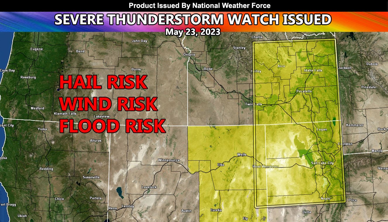
National Weather Force has issued a Severe Thunderstorm Watch effective today until midnight tonight for parts of Idaho, Utah, and Nevada.
An upper-level low dropping out of Western Canada today will move over the Oregon and Washington border. This upper-level system will provide the lifting within the eastern periphery, which will be enough for explosive thunderstorm development. General storm motion will be north-northeasterly across the watch area. A solid group of storms will be most prominent across Northern Nevada, stretching into the eastern half of Idaho, centering the Idaho Falls to Pocatello zones.
Instability will also be high across Salt Lake City, owning up to severe thunderstorm development there where large hail and damaging winds will be possible.

