
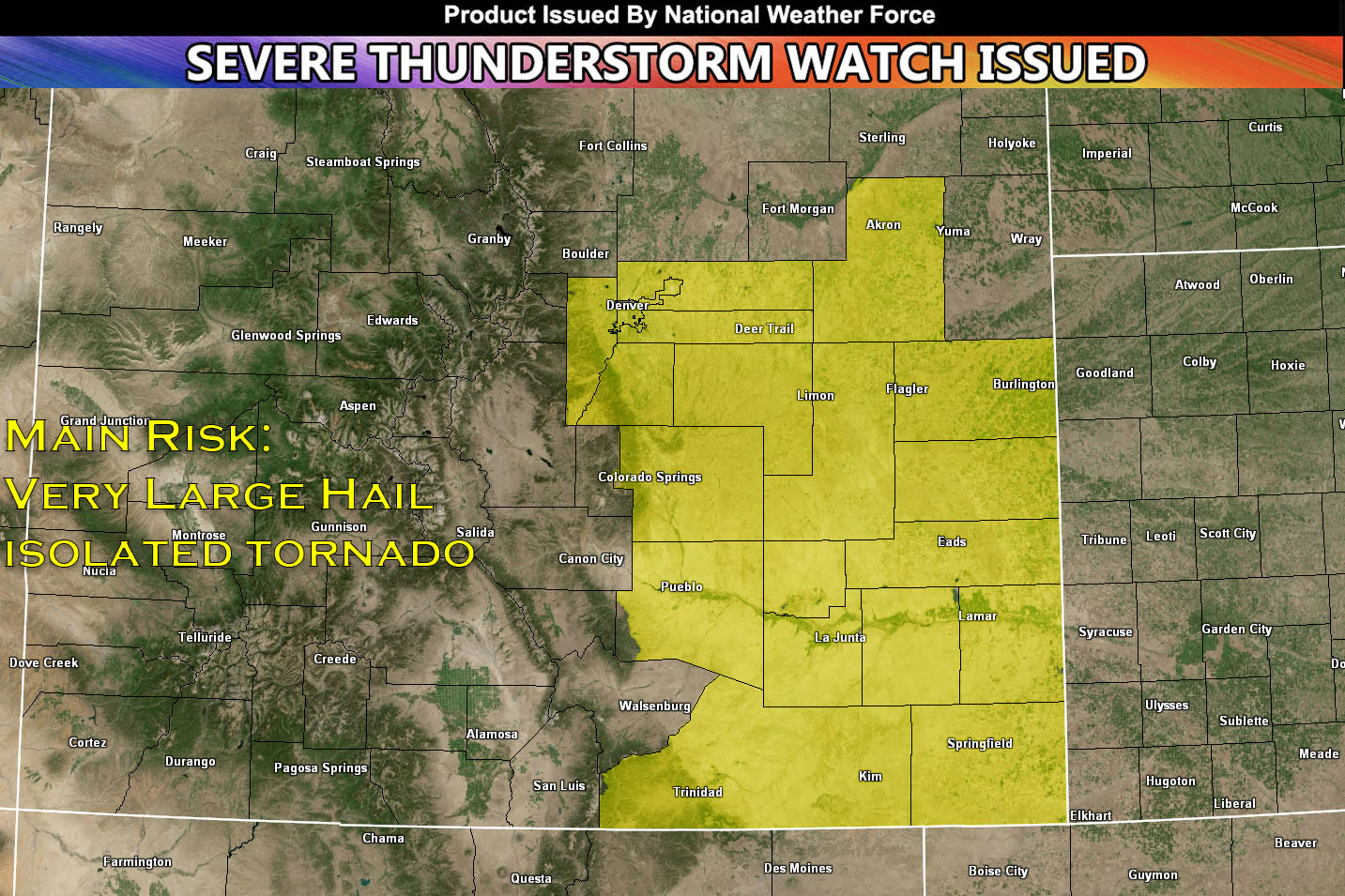
National Weather Force has issued a Severe Thunderstorm Watch/Outlook effective this evening and going until 8pm MDT tonight for Central to Southeast Colorado.
Convective activity has already been spotted and continues on throughout this evening. As up slope flow combines with moderate instability( caused by daylight) heating it will create an unstable atmosphere capable of strong to severe thunderstorms. These storms will from west and move east throughout the watch area. There will also be limited low level shear in the area which also brings in the risk of an isolated tornado. The main risk with these storms however will be very large hail approaching 2 inches. These storms will dissipate east of the favorable environment tonight.
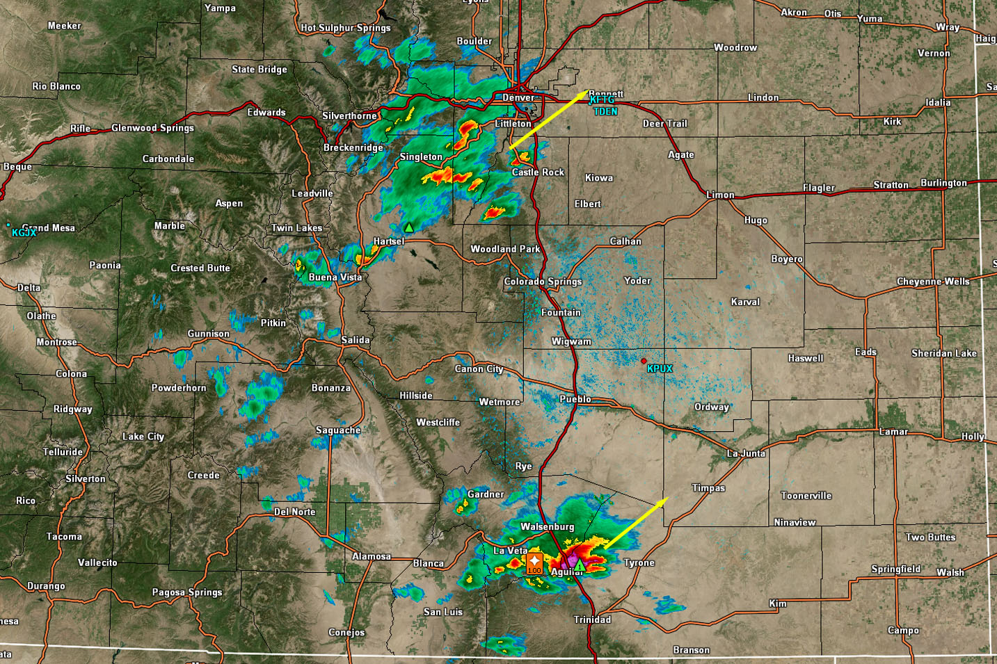
Below we can see on radar that storms are forming west and moving northeast.
End Article –
——————————
SIGN-UP TO THE FREE NWF E-MAIL ALERT SYSTEM FOR YOUR AREA HERE WHERE YOU PICK YOUR AREA IN YOUR OWN CONTROL PANEL BY STATE LOCATION AND GET NOTIFIED WHEN A POST IS MADE FOR YOU – https://www.nationalweatherforce.com/national-weather…/
WHAT IS NWF? ? ? ? This page/site is a custom weather forecast office for higher class events. Whether tornado, flood, winter, hurricane, or long-range issuance, the alert system works for your area. There are times you will see things here not posted elsewhere, or not at all.
The forecasts here are not developed by outside sources and is a full stacked private weather office for the nation, the first of its kind in issuing weather watches/advisories to the people in a private forum …
All you have to do is like/follow and the newsfeed will target your area. Oh, and get on the free e-mail alert system, you’ll be glad you did. Information is in the comment sections in alerts that matter the most to you, your family, or your friends – …
📷 📷Raiden Storm📷📷
Master General Meteorologist – is a consulting meteorologist with over 25 years’ experience for over 50 different companies, including energy, agriculture, aviation, marine, leisure, and many more areas. He has certs from Mississippi State for broadcast met and Penn State forecasting certs MET 101, 241, 341 and 361 as a meteorologist, but before then was completely self taught, barely learning a thing from the schools that he did not already know.
Both short and long-range is very important to know in those jobs so you can bet on accuracy here. He is versed in fields like Western USA, Tornadoes, Floods, Hurricanes, High Winds, Fire Behavior, Snow and Blizzards, Short Range, Long Range, Seasonal, and Life-Threatening decisions with over 25 years experience, out-forecasting all weather services available today with lead-time and precision, which makes him a focus of ridicule and envy.
NOTE: Alerts are posted on here, be it a tornado watch, etc, and these alerts are issued from this office and nowhere else. At times, which is often, you will see an alert forecast posted on here that you do not see elsewhere. That is fine, the track record of the main office is very high so maintain to follow an event when posted.