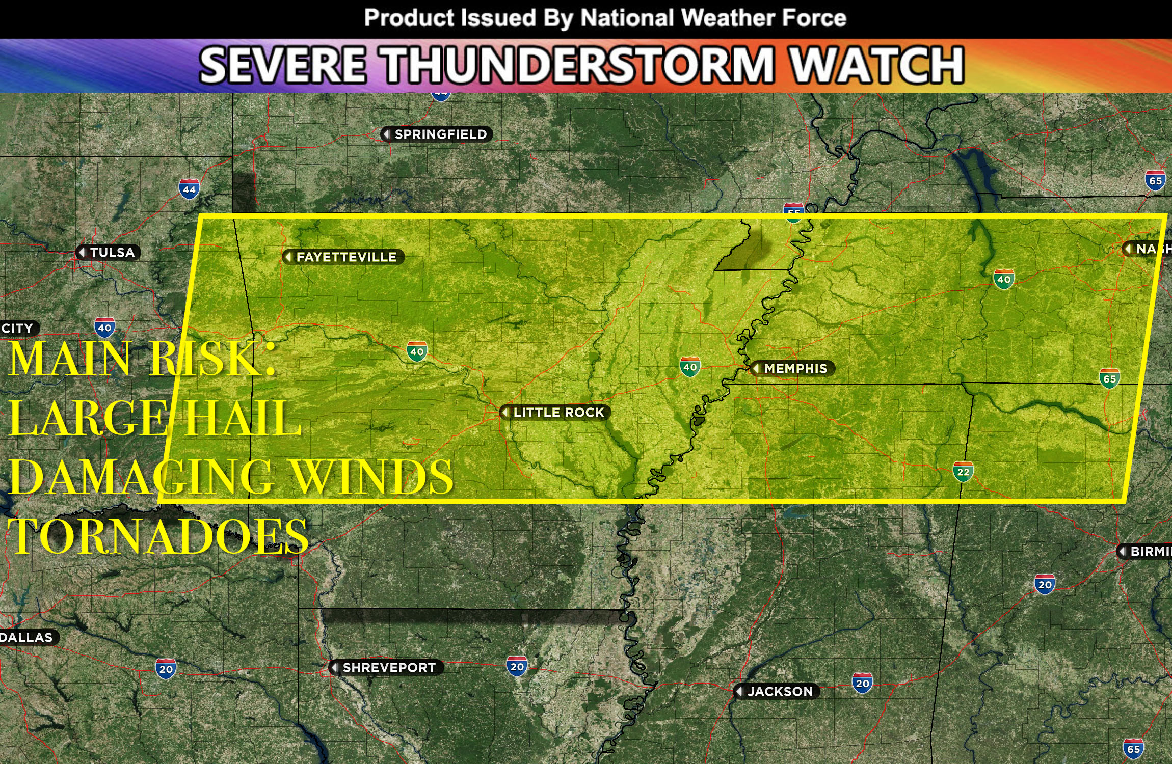
National Weather Force has issued a Severe Thunderstorm Watch effective until 2am EDT for southeast OK, east OK, northwest AR, west AR, north AR, central AR, northeast AR, east AR, west TN, southwest TN, northwest TN, central TN, Northwest MS, north MS, northeast MS, northwest AL and north AL.
Along a cold front, already a surge of warm, dense moisture, aided by substantial lift from the cold front can be seen in observations. Together with strong instability and vertical shear, this will initiate as multi-cellular storms, which may bring about various hazards. As the event unfolds, a Quasi-Linear Convective System, also known as a squall line (QLCS), is expected to roll southward across the region, delivering large hail and powerful winds. Furthermore, any independent cells may have the potential to generate tornadoes due to increased low-level shear.
As the night advances, this band of storms will persistently move through the remainder of the watch area, likely reaching northern Mississippi by early Monday morning. As the storm approaches these areas, the primary risk will remain strong winds.
Stay tuned for more updates.
Sina⚡⚡
A forecaster & developer with over 10+ years of experience in forecasting severe thunderstorms. Completely self taught in severe weather forecasting and computer science with a foundation from UNCO in Atmospheric Science. Moreover, he has been developing new tools to increase the chances of accurately forecasting large hail and tornadoes. A big contributor of National Weather Force bringing accuracy, timely information, and tools for keeping those impacted informed.
NOTE: Alerts are posted on here, be it a tornado watch, etc, and these alerts are issued from this office and nowhere else. At times, which is often, you will see an alert forecast posted on here that you do not see elsewhere. That is fine, the track record of the main office is very high so maintain to follow an event when posted.
