
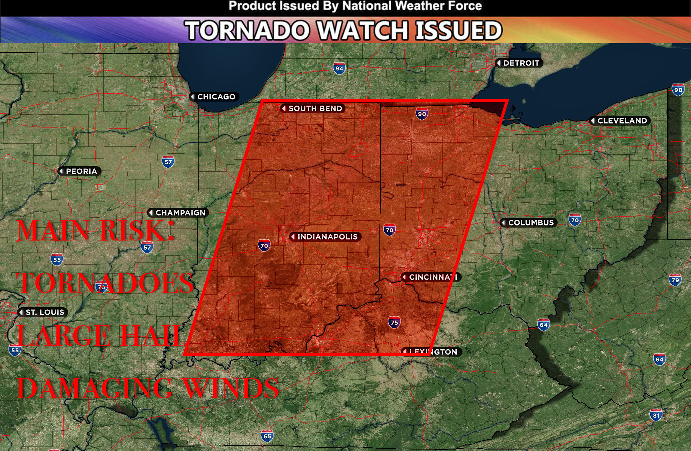
National Weather Force has issued a Tornado Watch effective for central IN, northeast IN, southeast IN, east IN, northwest OH, west OH, southwest OH, and north KY, until 8pm EDT.
Development of convection is expected to persist along an approaching cold front in the vicinity of the US-31/IN-15 corridors between 2 and 4pm. It may potentially upscale into one or two linear segments upon reaching I-69 and areas further east. Accompanying the closed mid-level low, notable area height drops will drive a pronounced cold front through the region, generating significant lift. This, in conjunction with a low-level jet introducing substantial vertical shear, can potentially trigger severe thunderstorms capable of producing tornadoes – potentially a few strong ones – given the strength of the low-level jet.
The most conducive conditions for tornado formation are anticipated at the intersection of Indiana, Ohio, and Kentucky. Moreover, each individual storm also carries threats of large hail and damaging winds. As the evening progresses, the storms are likely to evolve into a more linear pattern with an increasing emphasis on wind threats. This storm line is predicted to progress eastward throughout the night.
Stay tuned for more updates.
Sina⚡⚡
A forecaster & developer with over 10+ years of experience in forecasting severe thunderstorms. Completely self taught in severe weather forecasting and computer science with a foundation from UNCO in Atmospheric Science. Moreover, he has been developing new tools to increase the chances of accurately forecasting large hail and tornadoes. A big contributor of National Weather Force bringing accuracy, timely information, and tools for keeping those impacted informed.
NOTE: Alerts are posted on here, be it a tornado watch, etc, and these alerts are issued from this office and nowhere else. At times, which is often, you will see an alert forecast posted on here that you do not see elsewhere. That is fine, the track record of the main office is very high so maintain to follow an event when posted.