
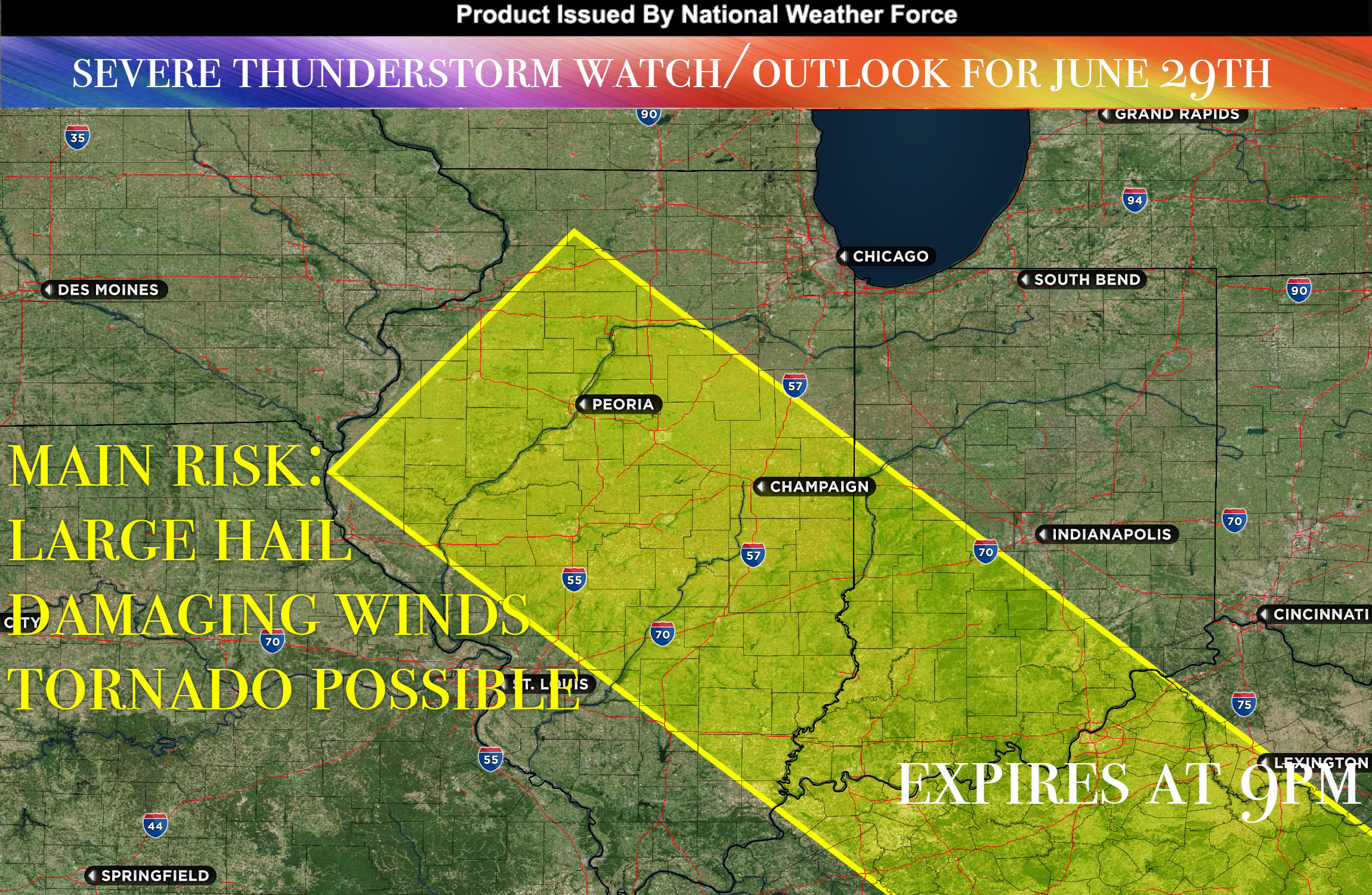
National Weather Force has issued a Severe Thunderstorm Watch/Outlook effective until 9pm CDT for Portions of IL into portions of IN and KY.
As a surface boundary, which stretches from western Iowa across Illinois, shifts across this region, it will carry along warm, moist air from southern regions over the impacted area. This warm, moist air is set to interact with the surface boundary, leading to the formation of a significant storm complex somewhere over Iowa, right on the nose of the low-level jet stream.
These storms are then likely to propagate along and north of this boundary, moving towards the east and possibly southeast into Illinois, portions of Indiana and Kentucky throughout the day. As this weather system moves, it’s expected to produce multiple rounds of storms. Given the atmospheric conditions, these storms have the potential to become severe and could persistently affect these regions for an extended period.
The risks associated with these weather conditions include damaging winds and large hail. Additionally, there’s the possibility of tornadoes forming within the more intense storm cells.
Stay tuned for more updates.
Sina⚡⚡
With over a decade of experience in forecasting severe thunderstorms, this individual is a seasoned forecaster and developer. Their expertise in severe weather forecasting and computer science is entirely self-taught, complemented by a foundation in Atmospheric Science from UNCO. They have dedicated their efforts to developing innovative tools that enhance the accuracy of predicting large hail and tornadoes. As a significant contributor to the National Weather Force, they have played a crucial role in providing accurate and timely information, as well as developing tools to keep those affected well-informed.
NOTE: Alerts are posted on here, be it a tornado watch, etc, and these alerts are issued from this office and nowhere else. At times, which is often, you will see an alert forecast posted on here that you do not see elsewhere. That is fine, the track record of the main office is very high so maintain to follow an event when posted.