
South of the weak frontal zone, the boundary layer may initially feel the impact of a considerable amount of outflow remnants from earlier storms. Additionally, sunlight striking the areas along and south of these boundaries is likely to lead to a sharper temperature gradient with increasing altitude, combined with significant levels of atmospheric instability. This is complemented by the seasonally high moisture content present in the area.
Combined with the winds in the upper atmosphere varying at different levels – a phenomenon known as wind shear – these conditions are ripe for severe storms. This dynamic mix is likely to trigger multiple waves of severe thunderstorms in the area, particularly considering these unstable conditions.
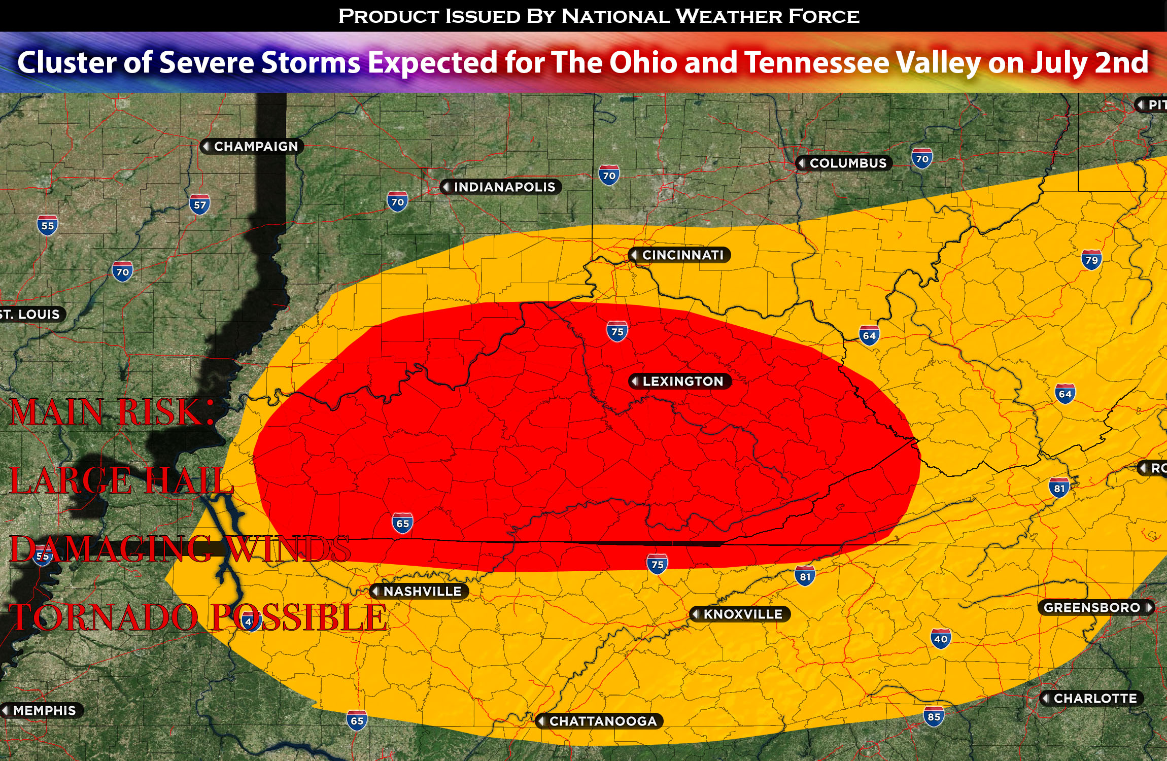
At first, the weather could give rise to isolated supercell thunderstorms. These are highly structured storms with a persistently rotating updraft, which could present a risk of severe hail. As the weather situation progresses, the main hazard may shift towards damaging wind gusts, especially those associated with expanding clusters of storms (especially later in the evening/overnight).
Main risk: large hail, damaging winds, tornado possible
Timing: late afternoon/evening into overnight.
Stay tuned for more updates.
Sina⚡⚡
With over a decade of experience in forecasting severe thunderstorms, this individual is a seasoned forecaster and developer. Their expertise in severe weather forecasting and computer science is entirely self-taught, complemented by a foundation in Atmospheric Science from UNCO. They have dedicated their efforts to developing innovative tools that enhance the accuracy of predicting large hail and tornadoes. As a significant contributor to the National Weather Force, they have played a crucial role in providing accurate and timely information, as well as developing tools to keep those affected well-informed.
NOTE: Alerts are posted on here, be it a tornado watch, etc, and these alerts are issued from this office and nowhere else. At times, which is often, you will see an alert forecast posted on here that you do not see elsewhere. That is fine, the track record of the main office is very high so maintain to follow an event when posted.