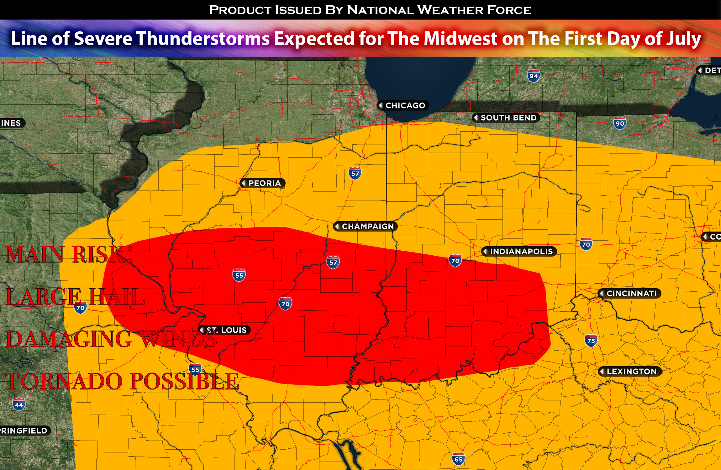
A mid-level atmospheric trough is set to shift eastwards, merging with notable instability, mid-level wind shifts, and abundant moisture. As a result, numerous thunderstorms – some of which could be severe – are likely to break out starting from the borders of Illinois and moving into the state. This will ultimately lead to the formation of a Mesoscale Convective System (MCS), a complex of organized severe thunderstorms, to the west and south of Illinois.
This stormy system will persistently move eastwards, potentially gaining strength as it enters Indiana on Saturday afternoon and extending into the evening hours. It will most likely continue into its neighboring states but continue to weaken before becoming mainly a wind and flooding threat. The main MCS (complex of severe thunderstorms) will bring a range of weather threats, including damaging winds and large hail. There is also a possibility of a tornado, especially in any isolated storm cells that develop ahead of the main system. Such cells, given their discrete nature, can sometimes intensify rapidly and pose a tornado risk. However, tornadoes will not be the main risk given the lack of low-level shear.
Threat: Large hail, damaging winds, tornadoes possible
Estimated Timing: Severe storms are expected to begin in the afternoon. Following this, a Mesoscale Convective System (MCS), a large grouping of storms, will develop and start to affect areas further to the east throughout Illinois. As the system continues its trajectory, it is projected to reach Indiana, most likely during the evening hours and persisting into the night.
Stay tuned for more updates.
Sina⚡⚡
With over a decade of experience in forecasting severe thunderstorms, this individual is a seasoned forecaster and developer. Their expertise in severe weather forecasting and computer science is entirely self-taught, complemented by a foundation in Atmospheric Science from UNCO. They have dedicated their efforts to developing innovative tools that enhance the accuracy of predicting large hail and tornadoes. As a significant contributor to the National Weather Force, they have played a crucial role in providing accurate and timely information, as well as developing tools to keep those affected well-informed.
NOTE: Alerts are posted on here, be it a tornado watch, etc, and these alerts are issued from this office and nowhere else. At times, which is often, you will see an alert forecast posted on here that you do not see elsewhere. That is fine, the track record of the main office is very high so maintain to follow an event when posted.
