
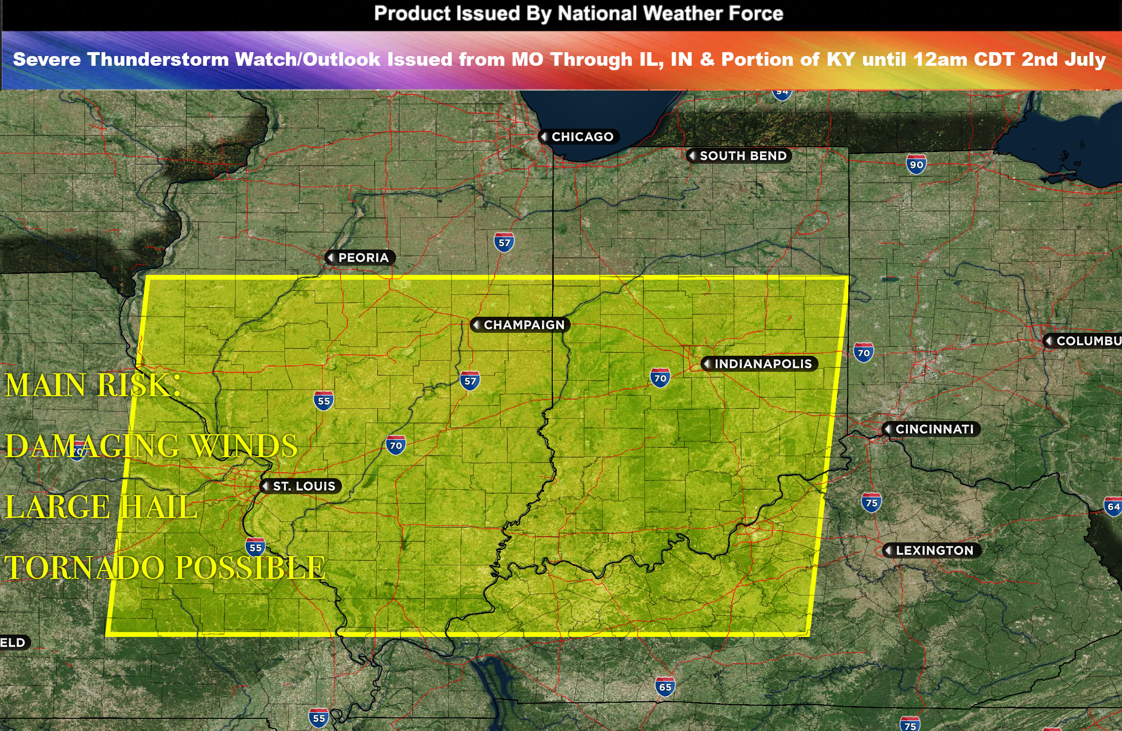
 National Weather Force has issued a Severe Thunderstorm Watch/Outlook effective until 12am CDT for eastern MO, most of IL, IN & into portions of KY.
An intensified shortwave trough, a type of atmospheric disturbance, is forecast to pass over the region by tonight (July 1st). As it does, it will revolve around its southern and eastern sections. The region is already undergoing destabilization with a wealth of moisture supplied by a warm front and a high level of atmospheric instability.
As this shortwave trough moves and rotates through the area, it will contribute to the development of scattered strong to severe thunderstorms. These storms are expected to intensify and eventually form a Mesoscale Convective System (MCS) as they traverse through Illinois and into Indiana.
The primary risks associated with these storms are damaging winds and large hail. There is also a chance for the formation of a tornado, particularly with the stronger and isolated storm cells. Such cells, given their independent nature, can sometimes intensify rapidly and pose a significant tornado risk.
Main risk: damaging winds, large hail, and tornado possible (discreet cells)
Timing: Evening into tonight from west to east forming in borders of IL/MO and moving throughout the region with the progression of the shortwave trough.
Stay tuned for more updates.
Sina⚡⚡
With over a decade of experience in forecasting severe thunderstorms, this individual is a seasoned forecaster and developer. Their expertise in severe weather forecasting and computer science is entirely self-taught, complemented by a foundation in Atmospheric Science from UNCO. They have dedicated their efforts to developing innovative tools that enhance the accuracy of predicting large hail and tornadoes. As a significant contributor to the National Weather Force, they have played a crucial role in providing accurate and timely information, as well as developing tools to keep those affected well-informed.
NOTE: Alerts are posted on here, be it a tornado watch, etc, and these alerts are issued from this office and nowhere else. At times, which is often, you will see an alert forecast posted on here that you do not see elsewhere. That is fine, the track record of the main office is very high so maintain to follow an event when posted.