
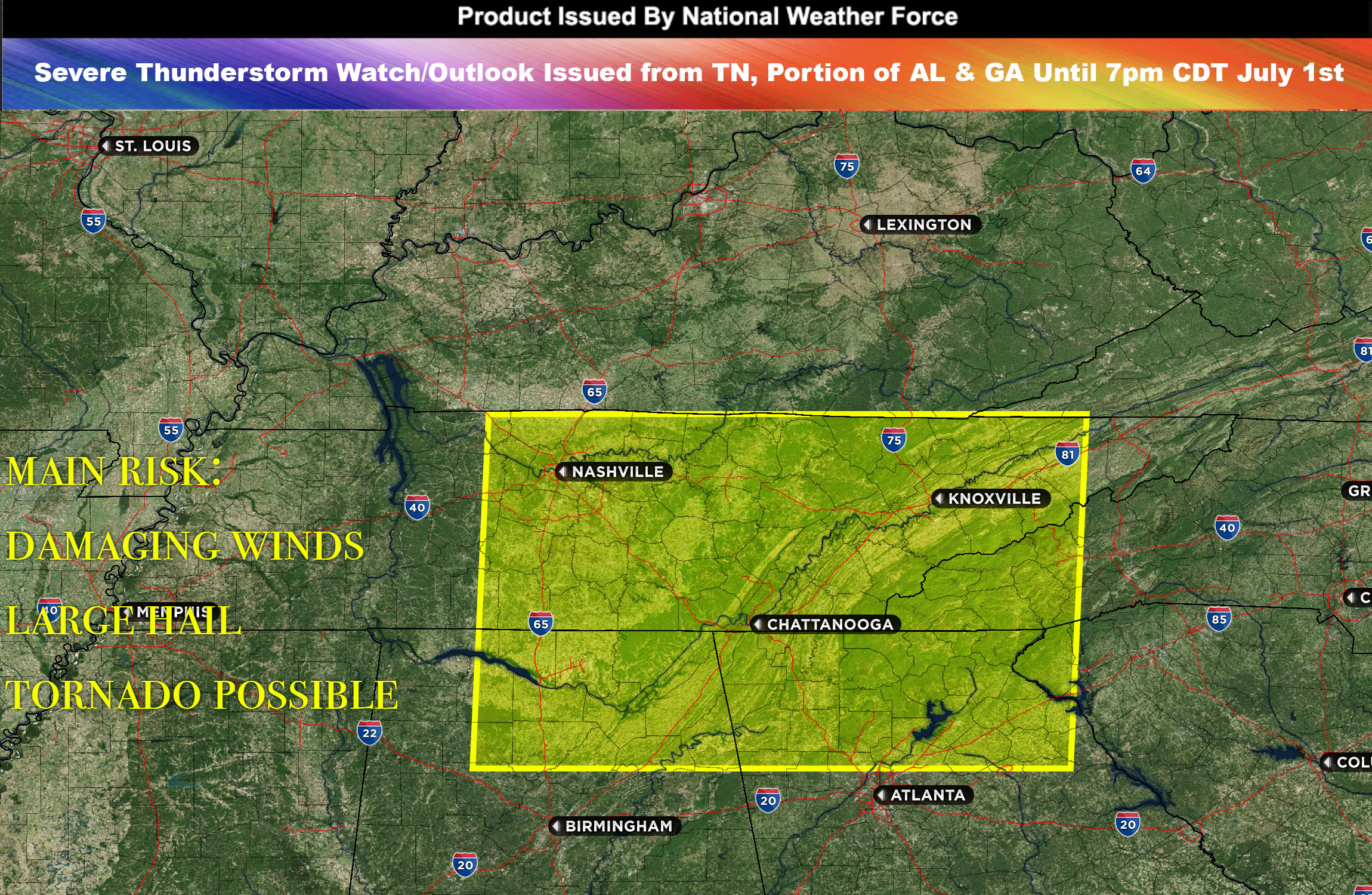
National Weather Force has issued a Severe Thunderstorm Watch/Outlook effective until 7pm CDT for TN, portions of AL, GA, and SC.
A line of severe storms has been spotted making their way through Tennessee, coupled with an array of thunderstorms scattering across the northern parts of Alabama and Georgia. These activities are the precursors to an upper-level trough, a broad area of relatively low atmospheric pressure, which is predicted to pass over this region.
The current atmospheric setup is already prone to instability, highlighted by elevated levels of atmospheric turbulence, mid-level wind changes, and substantial moisture content. This environment is favorable for the genesis of storms. The potential hazards these storms carry include damaging winds and, most notably, large hail.
These stormy conditions are projected to persist, moving eastward at a slow pace throughout this evening and into the night. As the trough progresses through the region later tonight, more storms could potentially develop. These developing conditions will continue to be closely monitored for any significant changes.
Main Threat: damaging winds, large hail, tornado possible
Stay tuned for more updates.
Sina⚡⚡
With over a decade of experience in forecasting severe thunderstorms, this individual is a seasoned forecaster and developer. Their expertise in severe weather forecasting and computer science is entirely self-taught, complemented by a foundation in Atmospheric Science from UNCO. They have dedicated their efforts to developing innovative tools that enhance the accuracy of predicting large hail and tornadoes. As a significant contributor to the National Weather Force, they have played a crucial role in providing accurate and timely information, as well as developing tools to keep those affected well-informed.
NOTE: Alerts are posted on here, be it a tornado watch, etc, and these alerts are issued from this office and nowhere else. At times, which is often, you will see an alert forecast posted on here that you do not see elsewhere. That is fine, the track record of the main office is very high so maintain to follow an event when posted.