
An eastward-moving low-pressure system originating from Canada is bringing a cold front through South Dakota. Meanwhile, a heat dome is developing from the southwest and it’s anticipated to hinder the southward movement of the cold front.
With high levels of humidity (dew points in the 60s and even higher in some areas) and increased atmospheric instability, thunderstorms are expected to develop across the region. Furthermore, deep layer wind shear – wind speed and direction changing with altitude – suggests these thunderstorms could intensify into a Mesoscale Convective System (MCS). This is a complex of thunderstorms that becomes organized on a scale larger than the individual thunderstorms and persists for several hours. The primary concern associated with this MCS is damaging wind gusts.
The formation of these storms is expected to start in the afternoon or evening and move across the region during the night. There’s also potential for another round of storms during the late-night hours, around 2-3am. These could also be severe, with damaging winds being the main threat, and will be closely monitored.
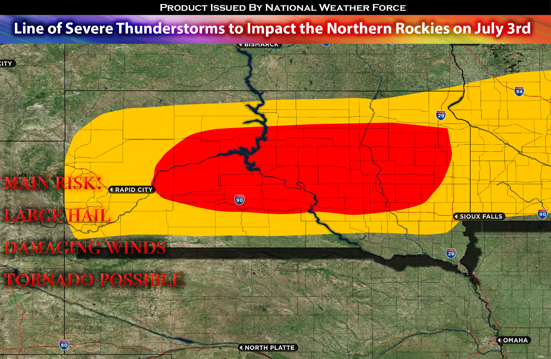
Main risk: large hail, damaging winds, tornado possible
Timing: late afternoon/evening into overnight.
Stay tuned for more updates.
Sina⚡⚡
With over a decade of experience in forecasting severe thunderstorms, this individual is a seasoned forecaster and developer. Their expertise in severe weather forecasting and computer science is entirely self-taught, complemented by a foundation in Atmospheric Science from UNCO. They have dedicated their efforts to developing innovative tools that enhance the accuracy of analyzing large hail and tornadoes. As a significant contributor to the National Weather Force, they have played a crucial role in providing accurate and timely information, as well as developing tools to keep those affected well-informed.
NOTE: The alerts and outlooks posted here are customary made to inform. At times, which is often, you will see an alert forecast posted on here that you do not see elsewhere. That is fine, the track record of the main office is very high so maintain to follow an event when posted. These are custom concentrated alerts and outlooks that are created by National Weather Force team of experts. They do not intend to represent the NWS or SPC.