
An upper-level trough is forecasted to continue moving east into Atlantic Canada. At the same time, the surface low pressure over the Midwest and interior Northeast is expected to lift into the Northeast on Monday. As a result, this will pull the trailing cold front across WV/NC tomorrow afternoon into the evening, before it stalls over our area Monday night.
Combined with the instability from daytime heating and stronger deep layer wind shear levels in this region, this will allow the thunderstorms to become more organized. The main risk from these storms will be damaging winds.
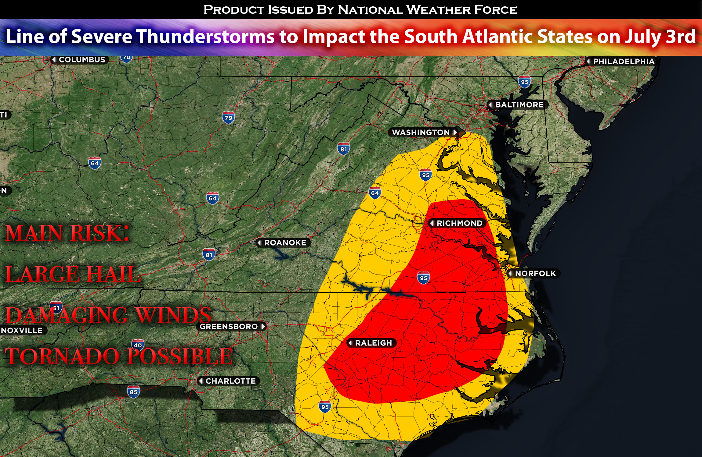
Main risk: large hail, damaging winds, tornado possible
Timing: late afternoon/evening into overnight.
Stay tuned for more updates.
Sina⚡⚡
With over a decade of experience in forecasting severe thunderstorms, this individual is a seasoned forecaster and developer. Their expertise in severe weather forecasting and computer science is entirely self-taught, complemented by a foundation in Atmospheric Science from UNCO. They have dedicated their efforts to developing innovative tools that enhance the accuracy of analyzing large hail and tornadoes. As a significant contributor to the National Weather Force, they have played a crucial role in providing accurate and timely information, as well as developing tools to keep those affected well-informed.
NOTE: The alerts and outlooks posted here are customary made to inform. At times, which is often, you will see an alert forecast posted on here that you do not see elsewhere. That is fine, the track record of the main office is very high so maintain to follow an event when posted. These are custom concentrated alerts and outlooks that are created by National Weather Force team of experts. They do not intend to represent the NWS or SPC.