
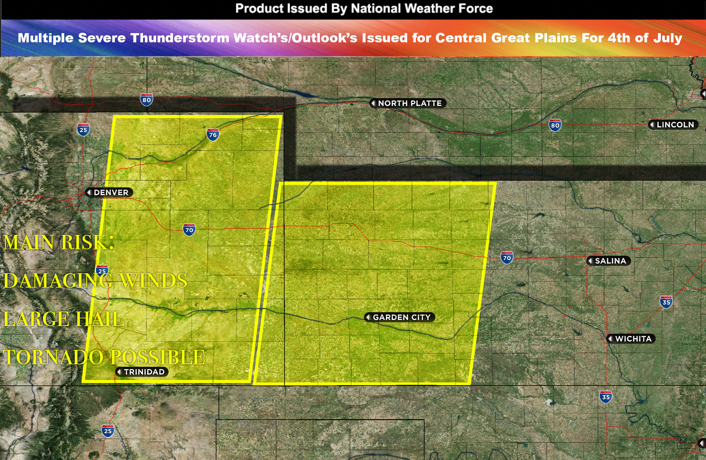
 National Weather Force severe thunderstorm watch/outlook effective until 11pm CDT for Eastern Colorado through portions of Kansas.
Severe thunderstorms, bringing large hail, damaging winds, and heavy rain, have been observed across the Colorado region. These storms are driven by a combination of steep temperature changes at mid-atmosphere levels and fast winds from the west centered over CO.
This atmospheric setup could result in the development of a few highly organized, long-lasting storms known as supercells. These supercells are capable of producing large hail and severe wind gusts. By early evening, these storms are likely to become more widespread over the central High Plains.
As these storms move away from the strong mid-atmosphere winds and towards the more stable lower atmosphere south of the front, they are expected to form into a larger storm system known as a Mesoscale Convective System (MCS).
The area immediately along the front will face the greatest risk of experiencing severe wind gusts and possibly a couple of tornadoes.
Main risk: large hail, damaging winds and tornado possible (discreet cells)
Timing: Afternoon into evening/overnight from west to east. Worse damaging wind threat after MCS forms into Kansas area.
Stay tuned for more updates.
—————-
Sina⚡⚡
With over a decade of experience in forecasting severe thunderstorms, this individual is a seasoned forecaster and developer. Their expertise in severe weather forecasting and computer science is entirely self-taught, complemented by a foundation in Atmospheric Science from UNCO. They have dedicated their efforts to developing innovative tools that enhance the accuracy of analyzing large hail and tornadoes. As a significant contributor to the National Weather Force, they have played a crucial role in providing accurate and timely information, as well as developing tools to keep those affected well-informed.
NOTE: The alerts and outlooks posted here are customary made to inform. At times, which is often, you will see an alert forecast posted on here that you do not see elsewhere. That is fine, the track record of the main office is very high so maintain to follow an event when posted. These are custom concentrated alerts and outlooks that are created by National Weather Force team of experts. They do not intend to represent the NWS or SPC.