
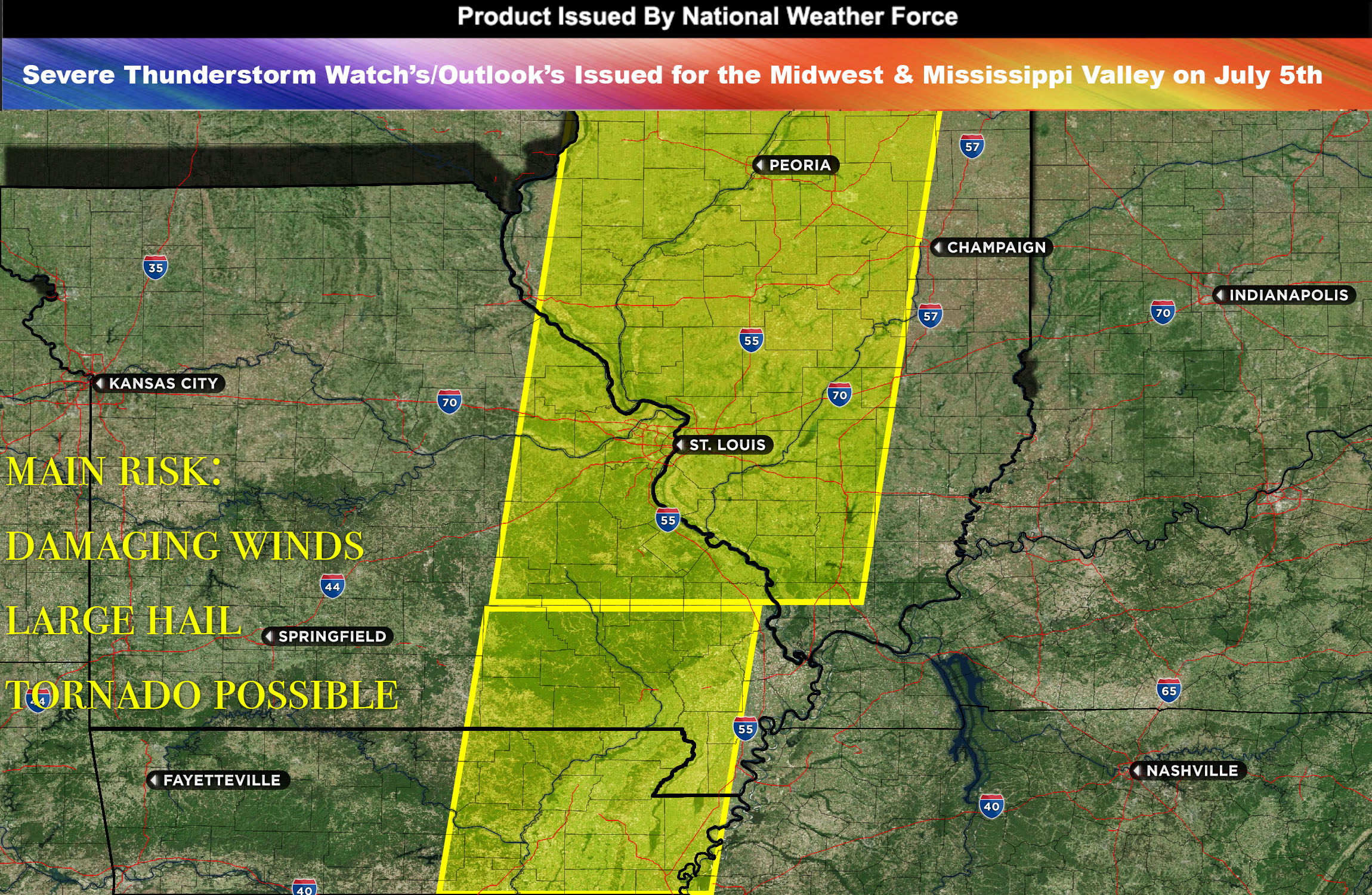
National Weather Force Severe Thunderstorm watch/outlook effective until 10pm CDT for IL, portions of MO and AR.
A cold front is expected to march southeastward across the region, and along its path, a chain of strong to severe storms is anticipated to form and move throughout the area from IL down through MO and portions of AR.
The cold front’s movement won’t be solitary. It’s set to accompany increased atmospheric instability and mid-layer wind shear. This combination, supplemented by an abundance of moisture, will stimulate the development of a powerful line of storms. Primarily, these storms are likely to produce damaging winds as they impact the area.
The formation of these storm systems is expected to commence around the afternoon hours. The storms will then traverse across the area, driven by atmospheric conditions and the forward momentum of the cold front. However, their presence is not expected to linger long into the night.
While the most intense storm activity associated with the cold front is expected to depart by the evening hours, the atmospheric conditions might still favor the development of additional scattered, pop-up storms. These could occur sporadically, even after the cold front has completed its passage through the area, bringing with them the possibility of further bouts of inclement weather.
Main Threat: damaging winds and large hail
Timing: afternoon/evening hours most likely starting around 2-3pm and passing through by 10pm (the main line).
Stay tuned for more updates.
Sina⚡⚡
With over a decade of experience in forecasting severe thunderstorms, this individual is a seasoned forecaster and developer. Their expertise in severe weather forecasting and computer science is entirely self-taught, complemented by a foundation in Atmospheric Science from UNCO. They have dedicated their efforts to developing innovative tools that enhance the accuracy of analyzing large hail and tornadoes. As a significant contributor to the National Weather Force, they have played a crucial role in providing accurate and timely information, as well as developing tools to keep those affected well-informed.
NOTE: The alerts and outlooks posted here are customary made to inform. At times, which is often, you will see an alert forecast posted on here that you do not see elsewhere. That is fine, the track record of the main office is very high so maintain to follow an event when posted. These are custom concentrated alerts and outlooks that are created by National Weather Force team of experts. They do not intend to represent the NWS or SPC.