
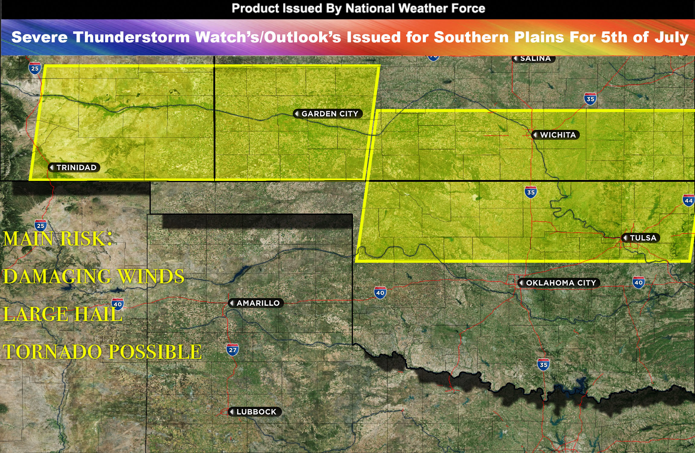
National Weather Force Severe Thunderstorm watch/outlook effective until 1am CDT Thursday morning for Southeast Colorado, portions of Kansas, and Oklahoma area.
A cold front is on the move, heading southeast across the central parts of the U.S. As it travels, it brings along heightened atmospheric instability and mid-level winds on its cooler side. Moreover, with lower-level winds shifting towards the east/southeast, the stage is set perfectly for the formation of severe isolated storms.
During the afternoon and evening, these storms are expected to form, initially appearing scattered across southeast Colorado and extending into parts of Kansas and Oklahoma. The primary threats from these storms are large hail, damaging winds, and possibly a few tornadoes, given the amplified lower-level wind shear.
As we move into the evening, these storms will evolve and align to form a linear system along the borders of Kansas and Oklahoma, creating what’s known as a Mesoscale Convective System (MCS). This line of storms will predominantly pose a threat of damaging winds as it continues its southeastward progression, affecting regions along its path.
Main risk: large hail, damaging winds and tornado possible
Timing: Afternoon into evening hours and overnight with each wave.
Stay tuned for more updates.
Sina⚡⚡
With over a decade of experience in forecasting severe thunderstorms, this individual is a seasoned forecaster and developer. Their expertise in severe weather forecasting and computer science is entirely self-taught, complemented by a foundation in Atmospheric Science from UNCO. They have dedicated their efforts to developing innovative tools that enhance the accuracy of analyzing large hail and tornadoes. As a significant contributor to the National Weather Force, they have played a crucial role in providing accurate and timely information, as well as developing tools to keep those affected well-informed.
NOTE: The alerts and outlooks posted here are customary made to inform. At times, which is often, you will see an alert forecast posted on here that you do not see elsewhere. That is fine, the track record of the main office is very high so maintain to follow an event when posted. These are custom concentrated alerts and outlooks that are created by National Weather Force team of experts. They do not intend to represent the NWS or SPC.