
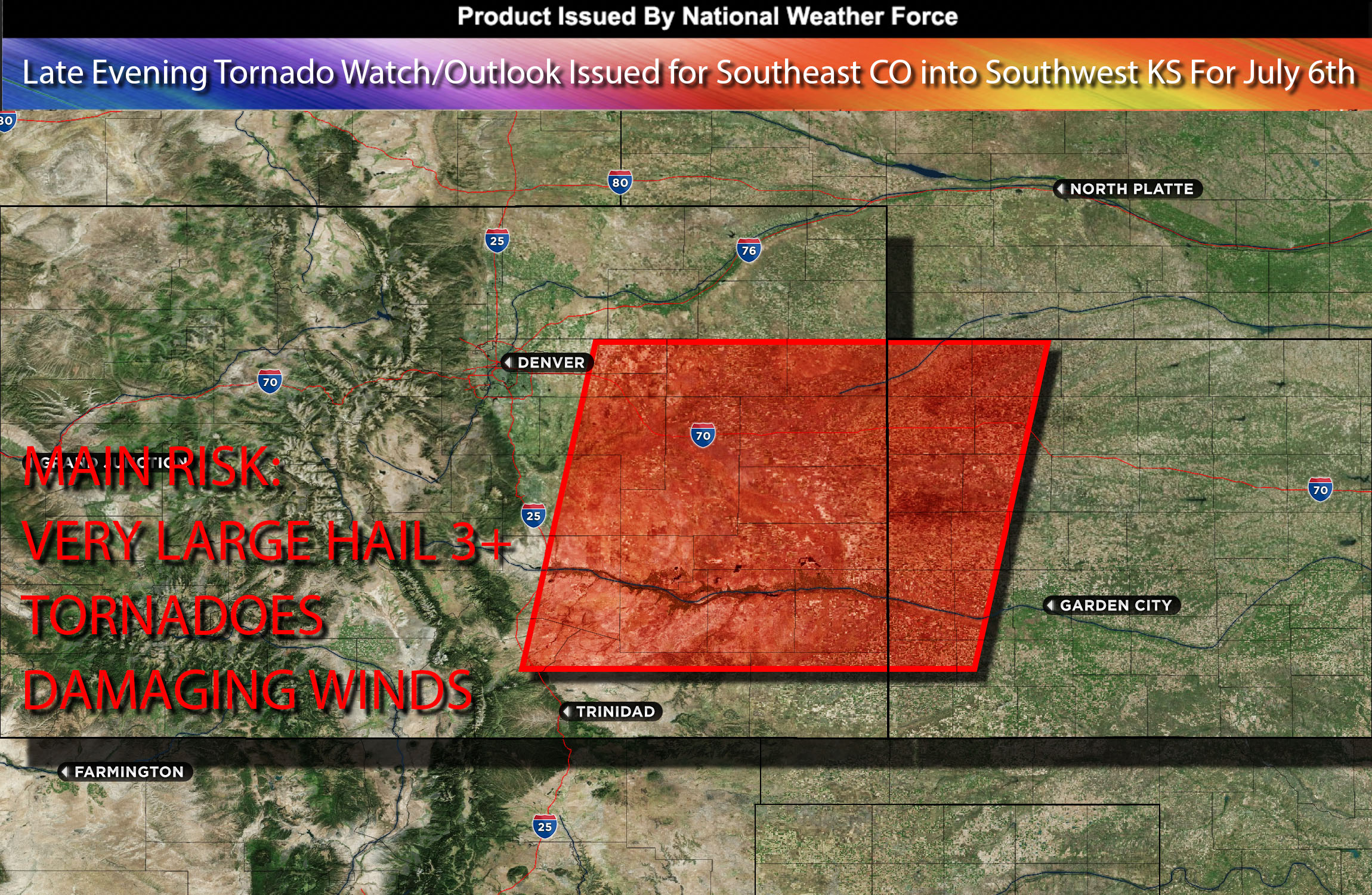
National Weather Force Tornado watch/outlook effective until 2am MDT for Southeast Colorado, and portions of Kansas.
As the day continues, more westerlies aloft will continue to cause clearing over the area allowing the atmosphere to destabilize further. As an atmospheric disturbance moves from the central Rockies to the Plains in the afternoon/evening, it will generate severe thunderstorms given the unstable airmass. The merging with dew points in the 50s and rapid atmospheric destabilization will increase instability, especially in southeastern Colorado. That combined with veering winds at different heights and stronger low-level shear will increase also the risk for tornadoes. Furthermore, any storms in these conditions could also yield large hailstones over 3 inches and damaging winds.
Main risk: Very large hail 3+ inches possible, tornadoes especially in eastern to southeastern CO and portions of KS area.
Timing: Late evening into overnight hours.
Stay tuned for more updates.
Sina⚡⚡
With over a decade of experience in forecasting severe thunderstorms, this individual is a seasoned forecaster and developer. Their expertise in severe weather forecasting and computer science is entirely self-taught, complemented by a foundation in Atmospheric Science from UNCO. They have dedicated their efforts to developing innovative tools that enhance the accuracy of analyzing large hail and tornadoes. As a significant contributor to the National Weather Force, they have played a crucial role in providing accurate and timely information, as well as developing tools to keep those affected well-informed.
NOTE: The alerts and outlooks posted here are customary made to inform. At times, which is often, you will see an alert forecast posted on here that you do not see elsewhere. That is fine, the track record of the main office is very high so maintain to follow an event when posted. These are custom concentrated alerts and outlooks that are created by National Weather Force team of experts. They do not intend to represent the NWS or SPC.