
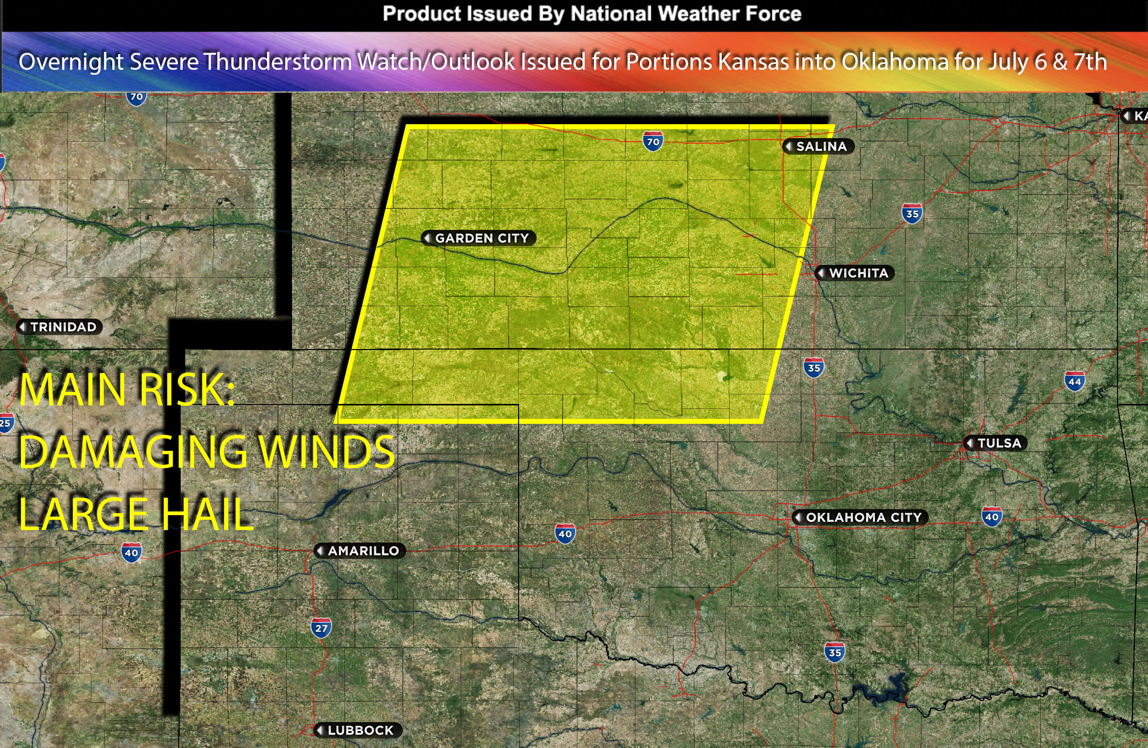
National Weather Force Severe Thunderstorm watch/outlook effective until 6am CDT for portions of west, southwest Kansas and northwest Oklahoma.
Severe thunderstorms have formed across eastern CO with many areas having reports of large hail, a few tornadoes and damaging winds due to the unstable air mass throughout the southeastern and eastern regions of Colorado. It is expected that these storms will progressively organize into a Mesoscale Convective System (MCS), sweeping through the western and southwestern areas of Kansas and advancing into Oklahoma overnight, leveraging the ongoing instability of the air mass as well as the ongoing low level jet stream that continues to bring the chance of a tornado or two.
The primary effect of these storms will be formidable straight-line winds, heavily affecting the regions they pass over. Furthermore, the creation of any outflow boundaries during this process may instigate additional storms. These storms however will die off into Oklahoma as the ingredients needed diminish overnight.
Main Threat: damaging straight-line winds and large hail, tornado possible.
Timing: Overnight into Friday early morning hours from Kansas into Oklahoma portions.
Stay tuned for more updates.
Sina⚡⚡
With over a decade of experience in forecasting severe thunderstorms, this individual is a seasoned forecaster and developer. Their expertise in severe weather forecasting and computer science is entirely self-taught, complemented by a foundation in Atmospheric Science from UNCO. They have dedicated their efforts to developing innovative tools that enhance the accuracy of analyzing large hail and tornadoes. As a significant contributor to the National Weather Force, they have played a crucial role in providing accurate and timely information, as well as developing tools to keep those affected well-informed.
NOTE: The alerts and outlooks posted here are customary made to inform. At times, which is often, you will see an alert forecast posted on here that you do not see elsewhere. That is fine, the track record of the main office is very high so maintain to follow an event when posted. These are custom concentrated alerts and outlooks that are created by National Weather Force team of experts. They do not intend to represent the NWS or SPC.