
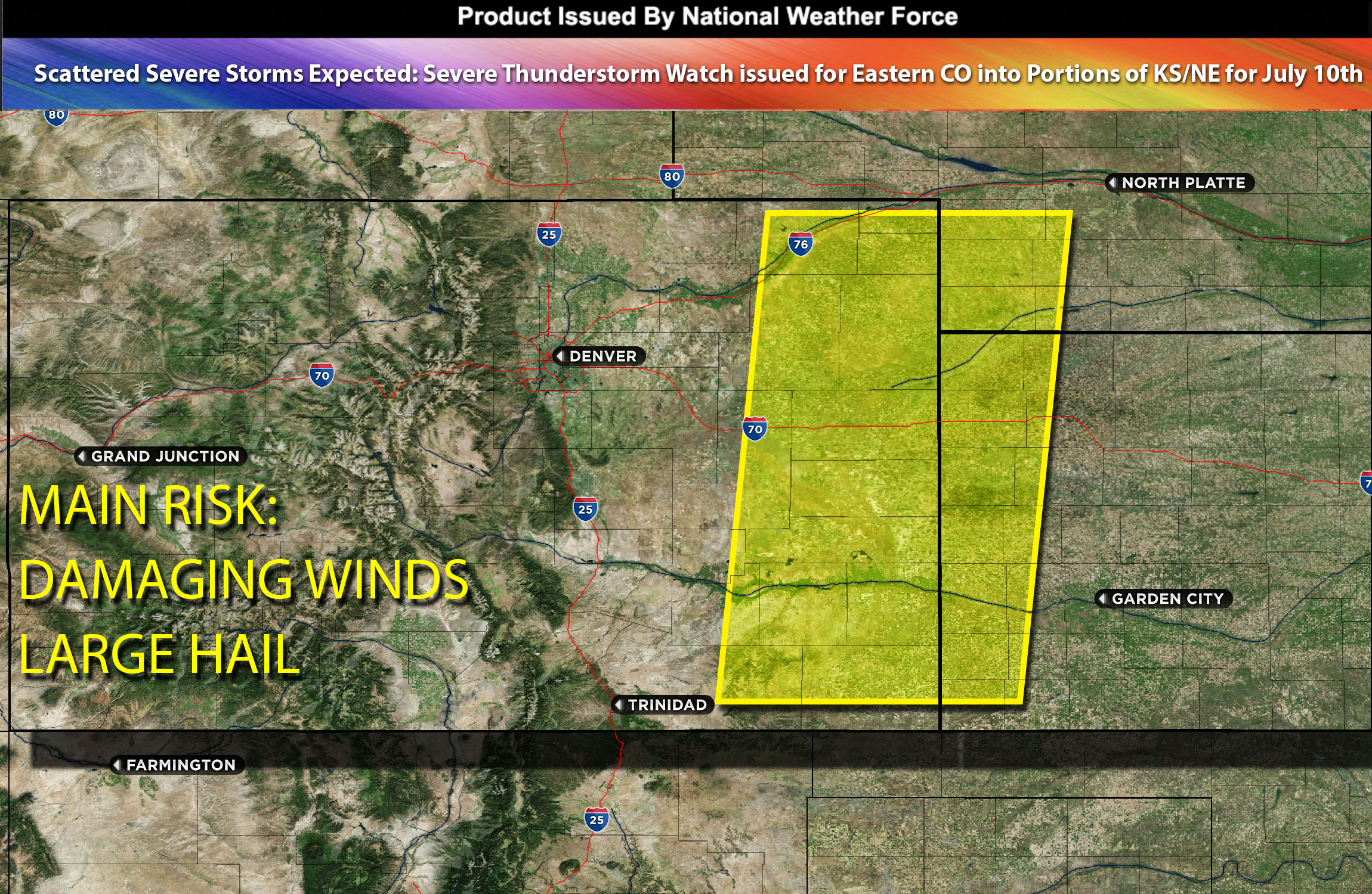
 National Weather Force Severe Thunderstorm watch/outlook effective until 9pm MDT for East and southeast CO.
A group of strong thunderstorms has formed over the Rocky Mountains and is now emerging over the eastern parts of CO. These storms are currently located in an area with temperatures in the mid/upper 80s and some elevated moisture. As a result, they are producing high-based storms that primarily pose a risk of strong winds. However, the greatest threat is expected to occur further east across Colorado, where dew points are in the 60s and there is some elevated instability to support them. Additionally, there is some moderate-level wind shear present, which, combined with these conditions, will likely lead to the development of large hail and potentially damaging winds, particularly in regions with higher instability. The most severe storms are expected to occur in the far extreme areas of Colorado, as well as in parts of Kansas and Nebraska.
Main Threat: damaging straight-line winds and large hail, very low risk for tornadoes.
Timing: This afternoon/evening
Stay tuned for more updates.
Sina⚡⚡
With over a decade of experience in forecasting severe thunderstorms, this individual is a seasoned forecaster and developer. Their expertise in severe weather forecasting and computer science is entirely self-taught, complemented by a foundation in Atmospheric Science from UNCO. They have dedicated their efforts to developing innovative tools that enhance the accuracy of analyzing large hail and tornadoes. As a significant contributor to the National Weather Force, they have played a crucial role in providing accurate and timely information, as well as developing tools to keep those affected well-informed.
NOTE: The alerts and outlooks posted here are customary made to inform. At times, which is often, you will see an alert forecast posted on here that you do not see elsewhere. That is fine, the track record of the main office is very high so maintain to follow an event when posted. These are custom concentrated alerts and outlooks that are created by National Weather Force team of experts. They do not intend to represent the NWS or SPC.