
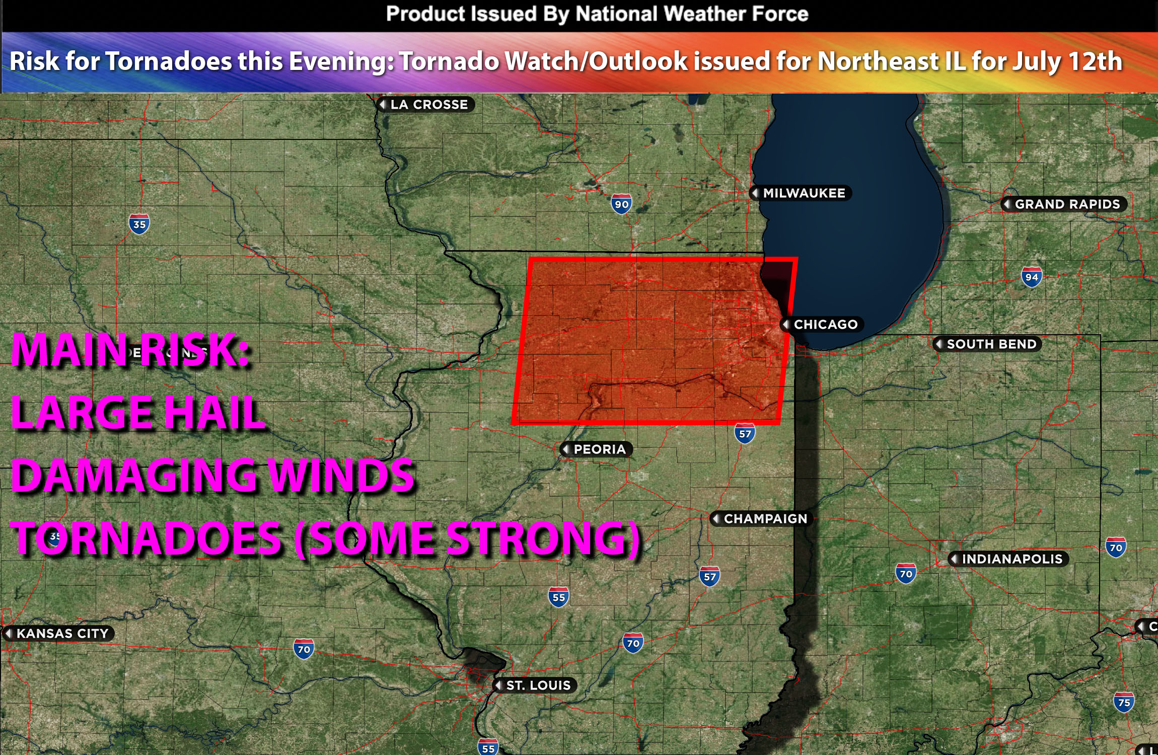
National Weather Force Tornado watch/outlook effective until 11pm CDT for north and northeast IL.
Despite an earlier passage of a Mesoscale Convective System (MCS) through Chicago, the area is already experiencing clearing skies and rapid warming due to strong mid-level flow winds in the upper atmosphere. Furthermore, an intensely humid air mass is present, growing stronger with dewpoints reaching into the 70s. These conditions, coupled with moderate instability and an oncoming warm front, will briefly foster an environment conducive to severe thunderstorms. The presence of a low-level jet stream, combined with ample vertical shear, escalates the risk of tornadoes, even potentially a strong one. Nevertheless, all thunderstorms this evening are likely to yield large hail and damaging winds.
Main risk: large hail, damaging winds, tornadoes possibly some strong.
Timing: Late this evening small time period.
Stay tuned for more updates.
Sina⚡⚡
With over a decade of experience in forecasting severe thunderstorms, this individual is a seasoned forecaster and developer. Their expertise in severe weather forecasting and computer science is entirely self-taught, complemented by a foundation in Atmospheric Science from UNCO. They have dedicated their efforts to developing innovative tools that enhance the accuracy of analyzing large hail and tornadoes. As a significant contributor to the National Weather Force, they have played a crucial role in providing accurate and timely information, as well as developing tools to keep those affected well-informed.
NOTE: The alerts and outlooks posted here are customary made to inform. At times, which is often, you will see an alert forecast posted on here that you do not see elsewhere. That is fine, the track record of the main office is very high so maintain to follow an event when posted. These are custom concentrated alerts and outlooks that are created by National Weather Force team of experts. They do not intend to represent the NWS or SPC.