
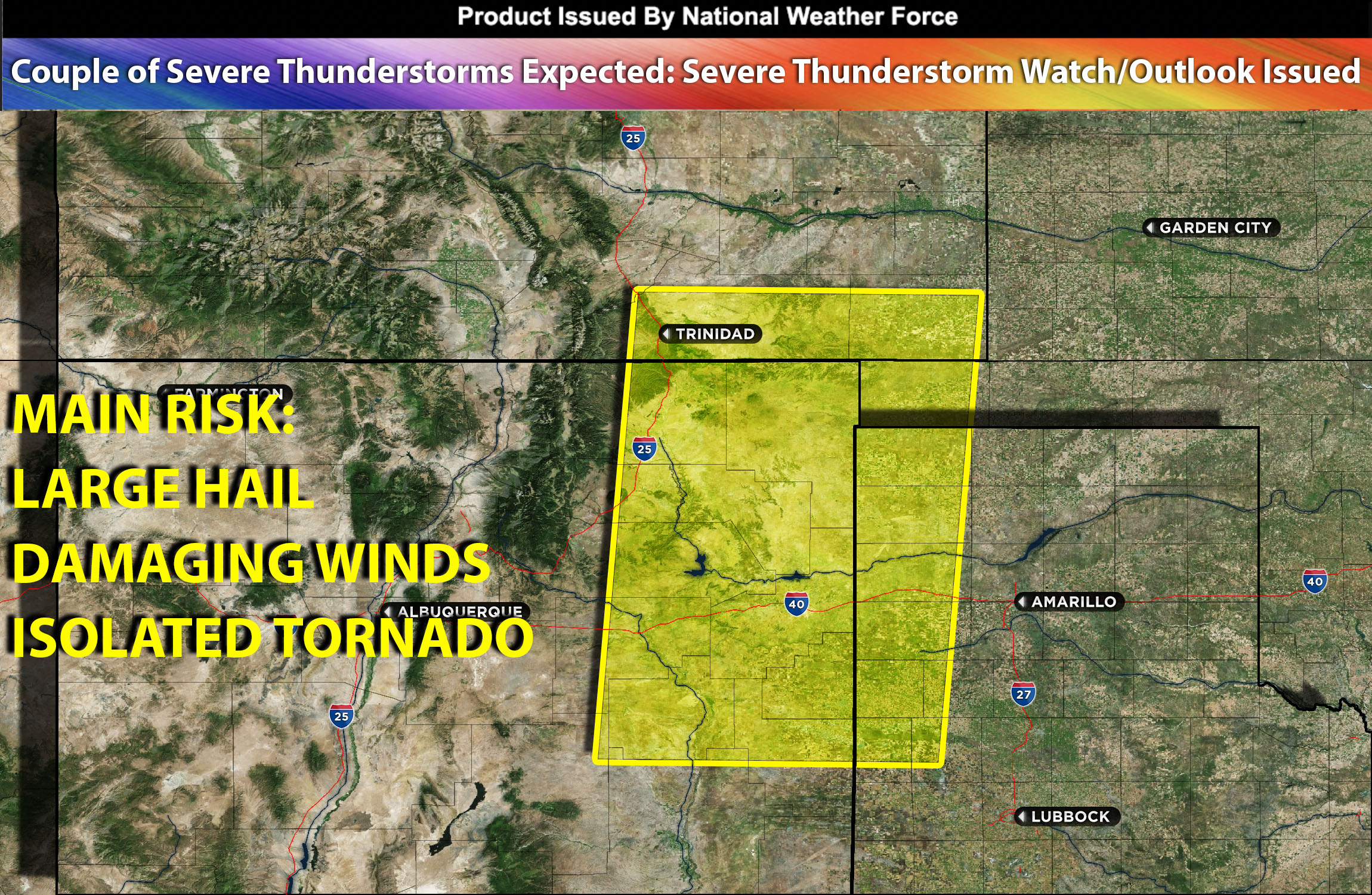
National Weather Force Severe Thunderstorm watch/outlook effective until 10pm MDT for portions of NM through south CO, TX, and OK Panhandle.
An outflow boundary from last night’s convection stretching from northeast New Mexico into the southern Texas Panhandle continues its westward trajectory towards the elevated terrain of northeast New Mexico. The clearing and warming of a moist air mass north of this boundary, paired with steep temperature differences in the atmosphere will steepen atmospheric instability by the late afternoon. This coupled with mid-level shear, this could lead to severe thunderstorms capable of generating large hail, destructive winds, and potentially a tornado. These storms will then later move into the Texas Panhandle and weaken as they move away from the boundary and less active ingredient area overnight.
Main risk: large hail, damaging winds, isolated tornado possible.
Timing: This afternoon into evening/overnight hours into TX.
Stay tuned for more updates.
Sina⚡⚡
With over a decade of experience in forecasting severe thunderstorms, this individual is a seasoned forecaster and developer. Their expertise in severe weather forecasting and computer science is entirely self-taught, complemented by a foundation in Atmospheric Science from UNCO. They have dedicated their efforts to developing innovative tools that enhance the accuracy of analyzing large hail and tornadoes. As a significant contributor to the National Weather Force, they have played a crucial role in providing accurate and timely information, as well as developing tools to keep those affected well-informed.
NOTE: The alerts and outlooks posted here are customary made to inform. At times, which is often, you will see an alert forecast posted on here that you do not see elsewhere. That is fine, the track record of the main office is very high so maintain to follow an event when posted. These are custom concentrated alerts and outlooks that are created by National Weather Force team of experts. They do not intend to represent the NWS or SPC.