
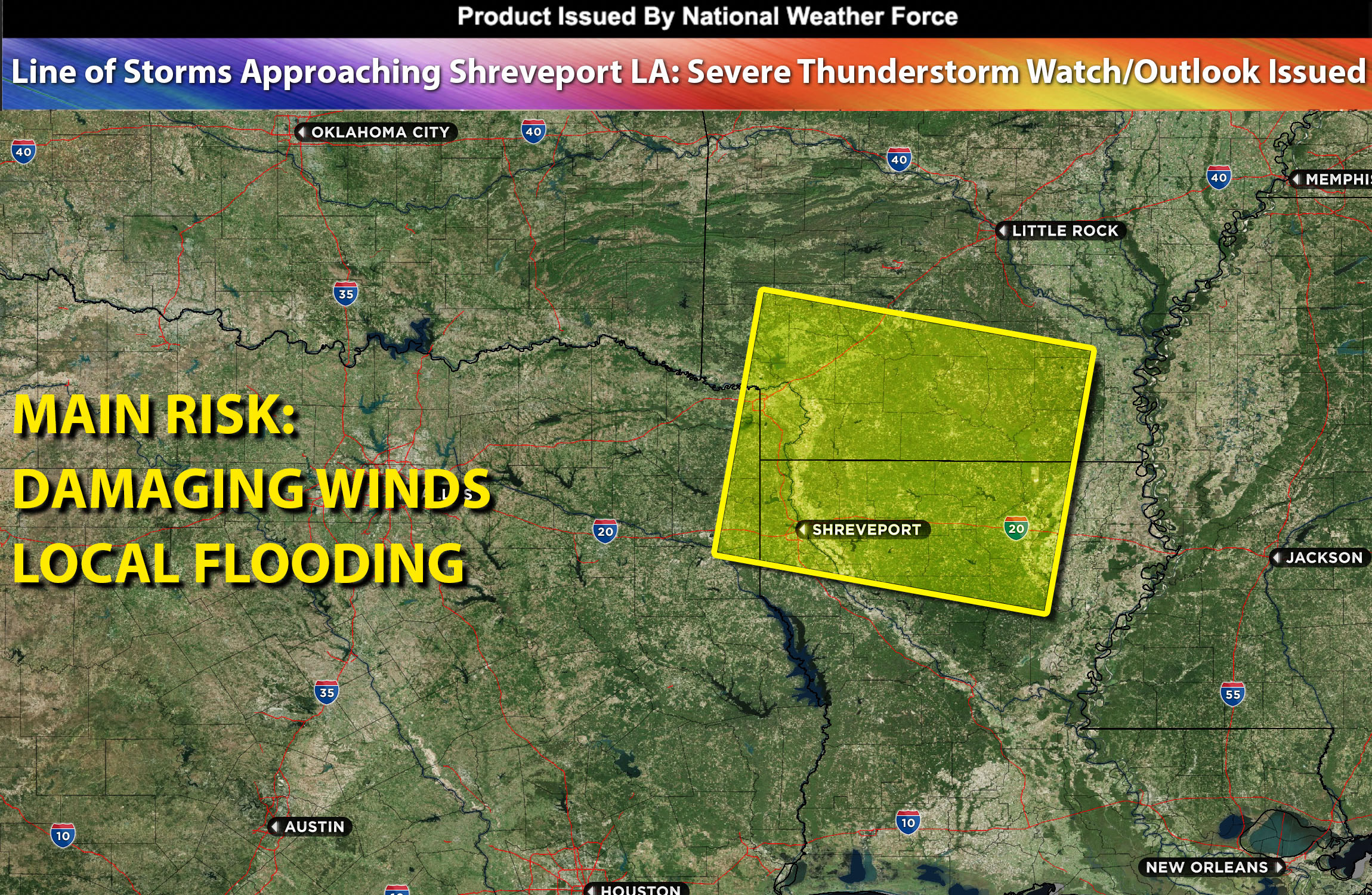
National Weather Force Severe Thunderstorm watch/outlook effective until 8pm CDT for portions of Louisiana, southwest Arkansas, and portions of east TX.
A persistent Mesoscale Convective System (MCS) is steadily moving southeast, gradually nearing the Shreveport area. The progression of this storm line into affected areas is anticipated to continue due to the daytime heating of a very moist air mass, leading to intense or locally extreme instability by the afternoon towards the Arklatex region. Despite the minimal shear, this convective system is likely to maintain its structure while migrating southeast in the afternoon. The primary hazards it poses include damaging straight-line winds and heavy rainfall.
Main risk: damaging straight-line winds, heavy rain.
Timing: This afternoon into evening moving southeast.
Stay tuned for more updates.