
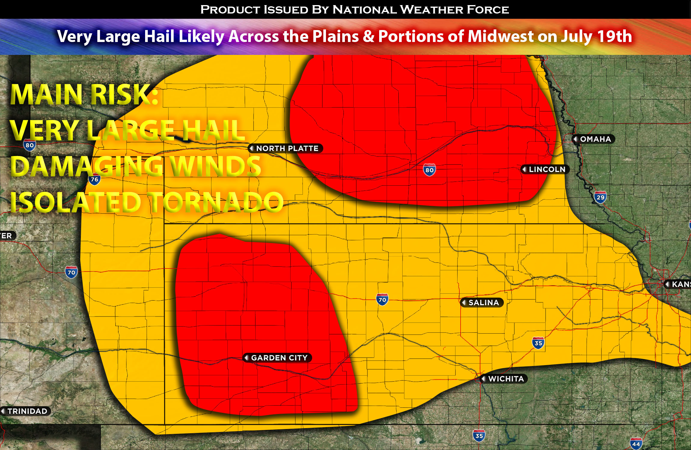
As an upper low moves southeast along of a cold front it will create convective activity along it. Daytime heating of a moist low-level airmass will instigate moderate to locally strong instability across parts MN NE, western KS and portions of north IA. Furthermore, activity also seems to be probable based on the atmosphere continuing to be unstable around late afternoon/evening hours. This combined with plenty of deep layer shear will create supercell thunderstorms posing risks of large hail and severe wind gusts. There is a good chance for also very large hail in central/eastern Nebraska, Kansas and portions of Minnesota/western Wisconsin area especially if these storms continue to intensify given the instability values.
Main risk: Large to very large hail, damaging winds, and very low risk for tornadoes (limited LLJ)
Timing: Storms are expected to form around 3-4pm CDT in the MN area and multiple rounds around the late afternoon/evening hours across eastern CO, KS, NE moving west to east.
Stay tuned for more updates.
Sina⚡⚡
With over a decade of experience in forecasting severe thunderstorms, this individual is a seasoned forecaster and developer. Their expertise in severe weather forecasting and computer science is entirely self-taught, complemented by a foundation in Atmospheric Science from UNCO. They have dedicated their efforts to developing innovative tools that enhance the accuracy of analyzing large hail and tornadoes. As a significant contributor to the National Weather Force, they have played a crucial role in providing accurate and timely information, as well as developing tools to keep those affected well-informed.
NOTE: The alerts and outlooks posted here are customary made to inform. At times, which is often, you will see an alert forecast posted on here that you do not see elsewhere. That is fine, the track record of the main office is very high so maintain to follow an event when posted. These are custom concentrated alerts and outlooks that are created by National Weather Force team of experts. They do not intend to represent the NWS or SPC.