
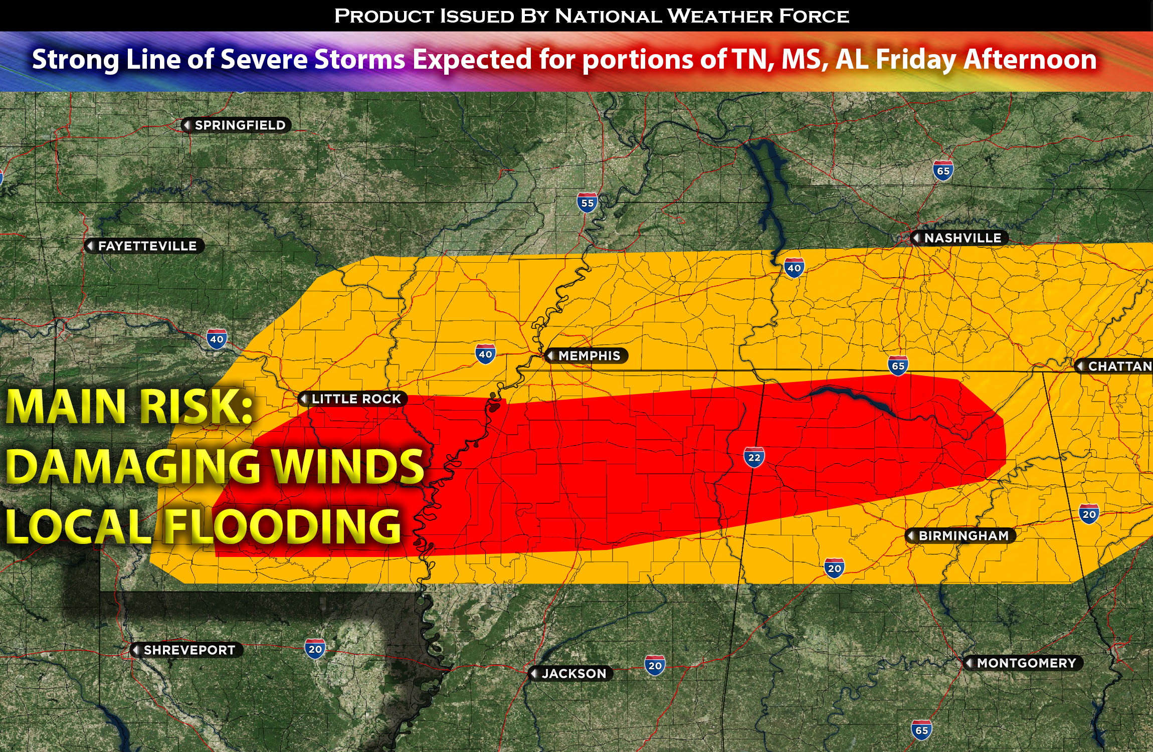
 A decently large Mesoscale Convective System (MCS) moved across southern Oklahoma last night and is now progressing into the northern and central regions of Arkansas. This weather system, along with its associated Mesoscale Convective Vortex (MCV), is expected to advance further into western Tennessee during the afternoon hours. With very plenty of heating and a highly moist air mass in the new area, the system may potentially re-intensify.
The combination of favorable atmospheric conditions, including high levels of downward instability and abundant moisture, creates a conducive environment for the development of damaging straight-line winds. This threat spans from Tennessee to the northern parts of Mississippi and Alabama. Properties, trees, and power lines in the affected regions could face significant risks due to these strong winds.
The weather system is expected to continue moving through the area overnight, prolonging the period of impact for the regions in its path. Residents in these areas should remain vigilant and prepared for potential hazards associated with severe weather, such as strong winds and heavy rainfall.
Main risk: damaging straight-line winds and local heavy rainfall.
Timing: The MCV is expected to push from AR into TN and re-intensify around the afternoon/evening and push to the other impacted regions overnight.
Stay tuned for more updates.
Sina⚡⚡
With over a decade of experience in forecasting severe thunderstorms, this individual is a seasoned forecaster and developer. Their expertise in severe weather forecasting and computer science is entirely self-taught, complemented by a foundation in Atmospheric Science from UNCO. They have dedicated their efforts to developing innovative tools that enhance the accuracy of analyzing large hail and tornadoes. As a significant contributor to the National Weather Force, they have played a crucial role in providing accurate and timely information, as well as developing tools to keep those affected well-informed.
NOTE: The alerts and outlooks posted here are customary made to inform. At times, which is often, you will see an alert forecast posted on here that you do not see elsewhere. That is fine, the track record of the main office is very high so maintain to follow an event when posted. These are custom concentrated alerts and outlooks that are created by National Weather Force team of experts. They do not intend to represent the NWS or SPC.