
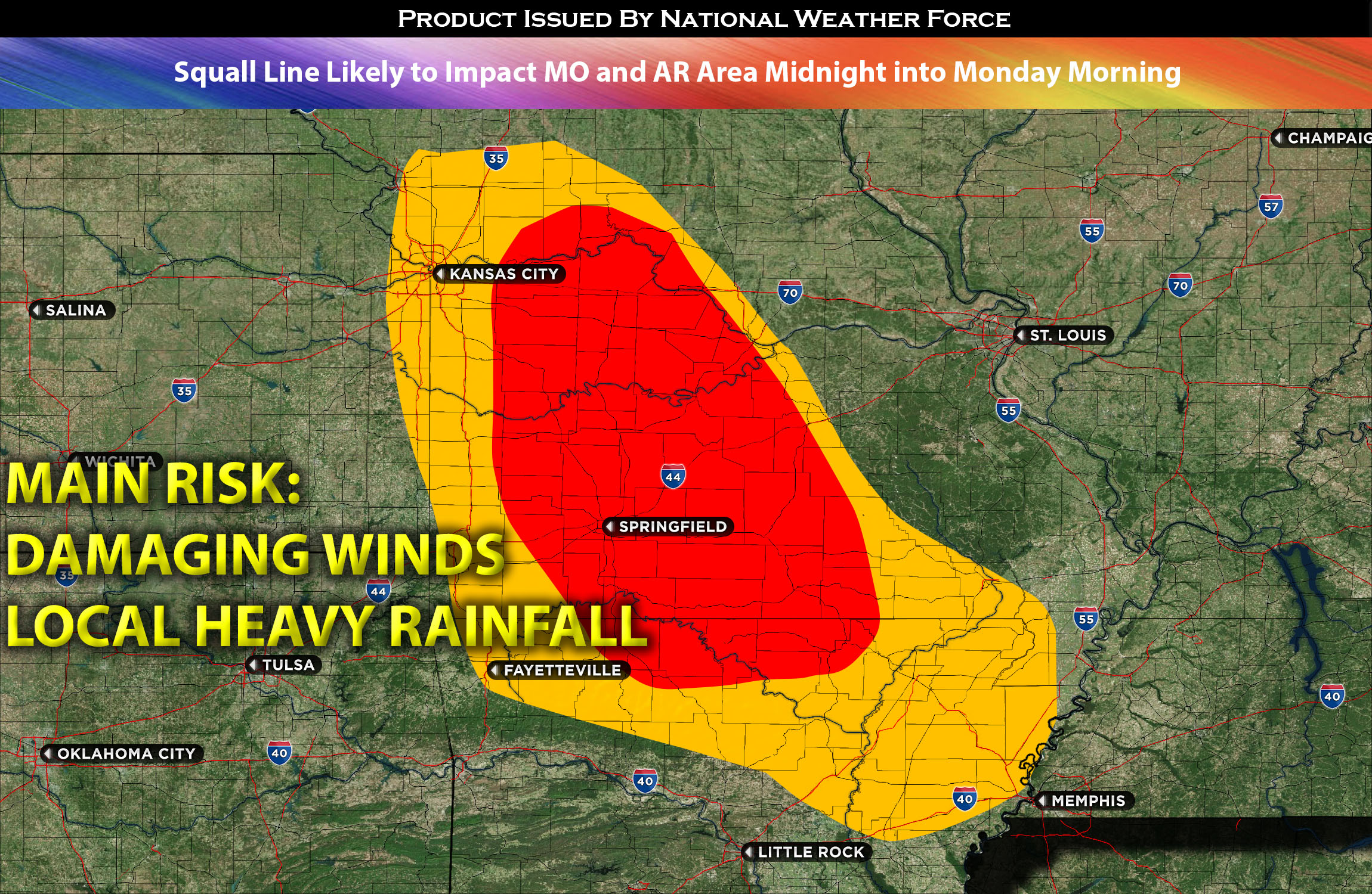
 The air mass for Missouri anticipates the existing atmospheric cap to persist throughout today, despite high instability, substantial mid-level moisture, and shear particularly in the southwest region. However, the situation is expected to evolve as this cap weakens during the night and into Monday morning. A Mesoscale Convective System (MCS) is predicted to emerge in Northwestern Missouri, sweeping through the central and southern parts of the state. This will bring with it the threat of damaging winds and localized heavy rainfall.
The system is anticipated to continue its trajectory southeastward into parts of Arkansas, with Northern Arkansas being particularly vulnerable given the ongoing presence of severe weather conditions. The primary risks associated with these storm lines remain damaging winds and heavy localized rainfall.
Main risk: damaging straight-line winds, local flooding given heavy rainfall.
Timing: Sunday midnight into Monday morning from MO northwest and southeastward through MO and into AR northeast.
Stay tuned for more updates.
Sina⚡⚡
With over a decade of experience in forecasting severe thunderstorms, this individual is a seasoned forecaster and developer. Their expertise in severe weather forecasting and computer science is entirely self-taught, complemented by a foundation in Atmospheric Science from UNCO. They have dedicated their efforts to developing innovative tools that enhance the accuracy of analyzing large hail and tornadoes. As a significant contributor to the National Weather Force, they have played a crucial role in providing accurate and timely information, as well as developing tools to keep those affected well-informed.
NOTE: The alerts and outlooks posted here are customary made to inform. At times, which is often, you will see an alert forecast posted on here that you do not see elsewhere. That is fine, the track record of the main office is very high so maintain to follow an event when posted. These are custom concentrated alerts and outlooks that are created by National Weather Force team of experts.