
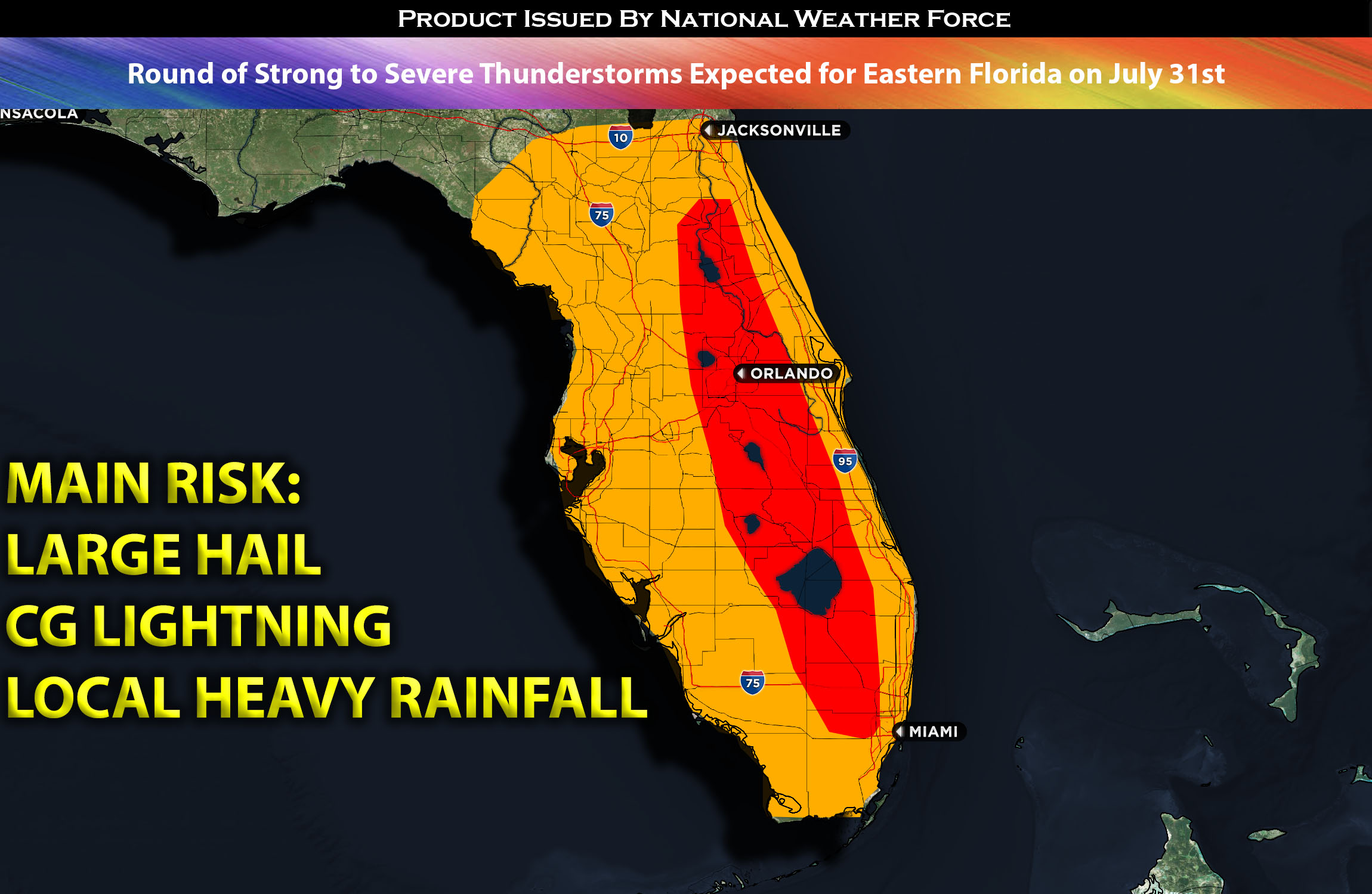
A surface trough is anticipated to form across the southeastern United States by this afternoon, causing increased lifting. A persistent west and southwest flow will remain throughout the region. In combination with a highly humid air mass, increased instability, and elevated shear, these conditions pose a risk of strong, and potentially severe, thunderstorms in Florida. These weather components will likely trigger storm formation around midday, with activity intensifying across eastern and central Florida. However, these storms are projected to dissipate in the evening as the contributing elements lessen.
Main risk: large hail, CG lightning and local heavy rainfall
Timing: This afternoon and evening diminishing after sunset.
Locations Impacted: Central and eastern FL (north and south).
Stay tuned for more updates.
Sina⚡⚡
With over a decade of experience in forecasting severe thunderstorms, this individual is a seasoned forecaster and developer. Their expertise in severe weather forecasting and computer science is entirely self-taught, complemented by a foundation in Atmospheric Science from UNCO. They have dedicated their efforts to developing innovative tools that enhance the accuracy of analyzing large hail and tornadoes. As a significant contributor to the National Weather Force, they have played a crucial role in providing accurate and timely information, as well as developing tools to keep those affected well-informed.
NOTE: The alerts and outlooks posted here are customary made to inform. At times, which is often, you will see an alert forecast posted on here that you do not see elsewhere. That is fine, the track record of the main office is very high so maintain to follow an event when posted. These are custom concentrated alerts and outlooks that are created by National Weather Force team of experts.