
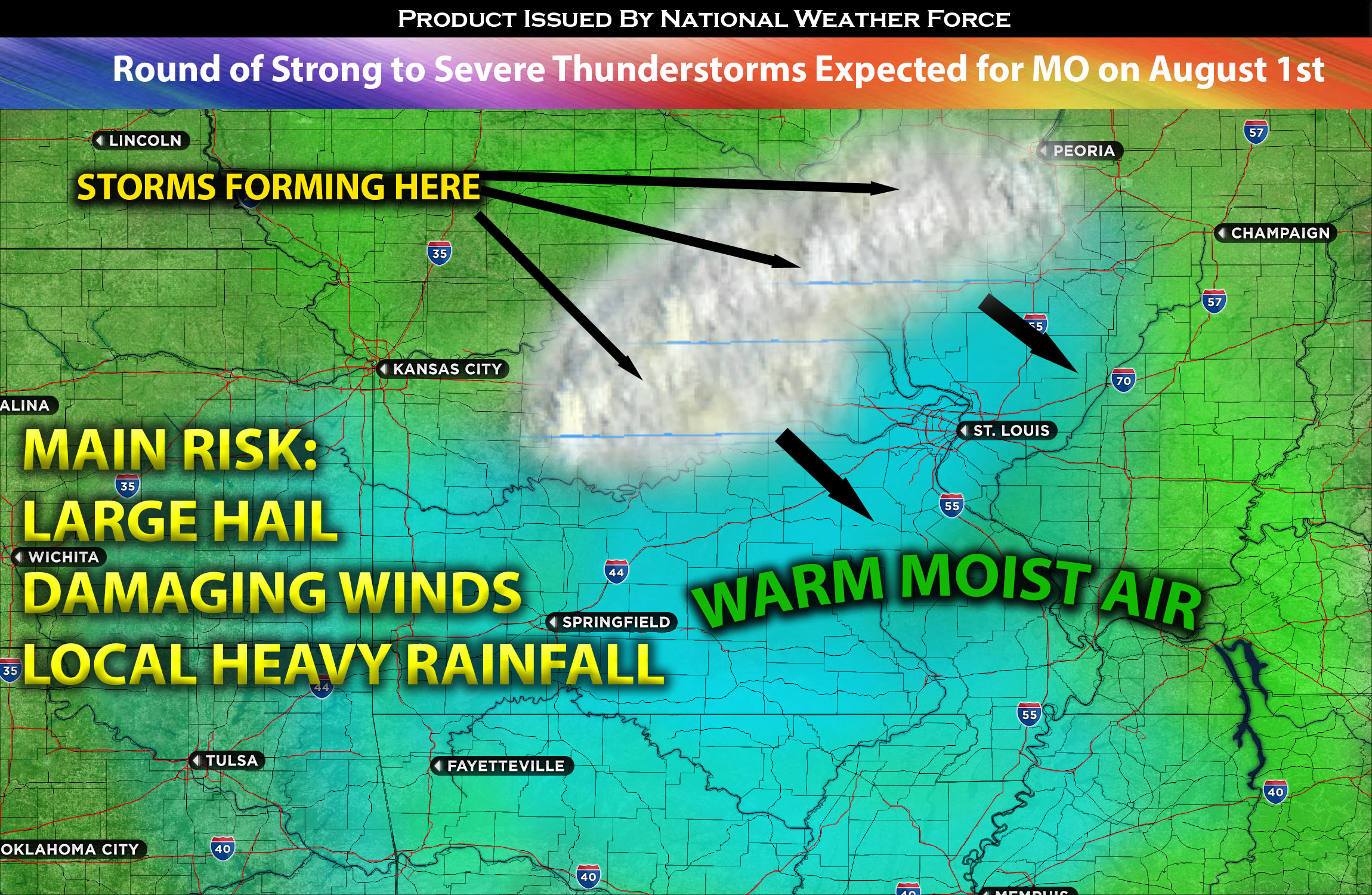
Currently, Missouri is experiencing numerous thunderstorms. However, these storms are forecasted to subside in the following hours given the lack of inflow from low LLJ (low level jet). Further storm activity, of a convective nature, is expected to intermittently develop across northeastern Missouri later this evening as the atmosphere continues to become unstable with a warm advective airmass and continue overnight, moving southeast across the state. Accompanied by potential large hail and damaging straight-line winds, these storms are expected to traverse northeastern Missouri before once again decreasing in intensity during the early hours of Wednesday. These storms will continue to push through IL westward and quickly diminish given the lack of ingredients (early morning on Wednesday) with mainly bringing local heavy rainfall.
Here is a graphical representation of where storms are expected to form and move through the impacted regions overnight.
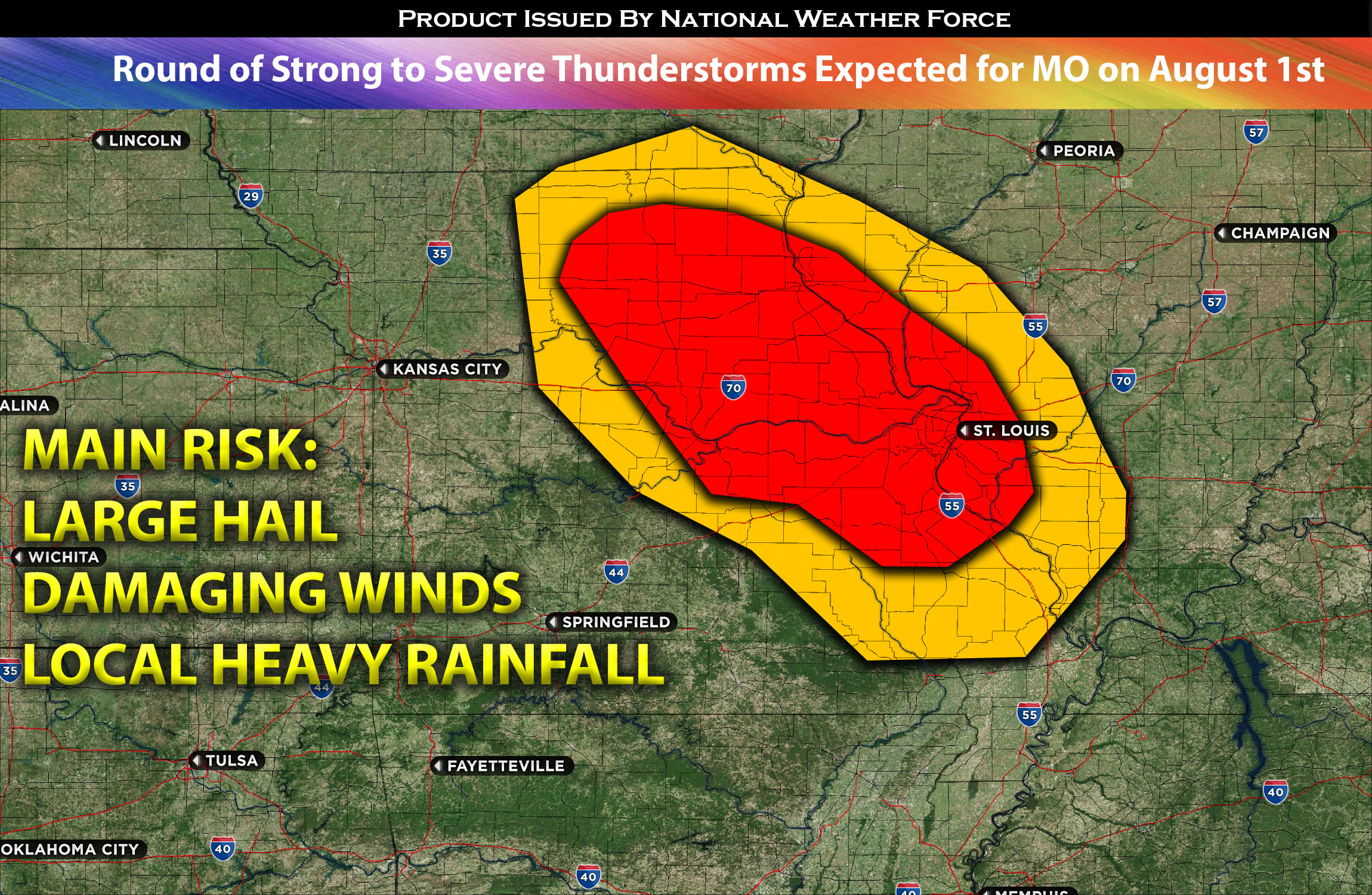
Main risk: large hail, damaging straight-line winds, CG lightning.
Timing: This evening into overnight from northeast to southeast MO into portions of southwestern IL.
Locations Impacted: northeastern, southeastern, and southern MO into portions of southwestern IL.
Stay tuned for more updates.
Sina⚡⚡
With over a decade of experience in forecasting severe thunderstorms, this individual is a seasoned forecaster and developer. Their expertise in severe weather forecasting and computer science is entirely self-taught, complemented by a foundation in Atmospheric Science from UNCO. They have dedicated their efforts to developing innovative tools that enhance the accuracy of analyzing large hail and tornadoes. As a significant contributor to the National Weather Force, they have played a crucial role in providing accurate and timely information, as well as developing tools to keep those affected well-informed.
NOTE: The alerts and outlooks posted here are customary made to inform. At times, which is often, you will see an alert forecast posted on here that you do not see elsewhere. That is fine, the track record of the main office is very high so maintain to follow an event when posted. These are custom concentrated alerts and outlooks that are created by National Weather Force team of experts.