
An approaching mid-level trough will travel southeastward across the Great Plains from the North. During the afternoon and evening, a combination of moderate mid-level westerly flow and east/southeasterly low-level flow will maintain sufficient moisture levels in the region. Additionally, there will be strong instability and elevated mid-level shear, creating favorable conditions for organized severe thunderstorms.
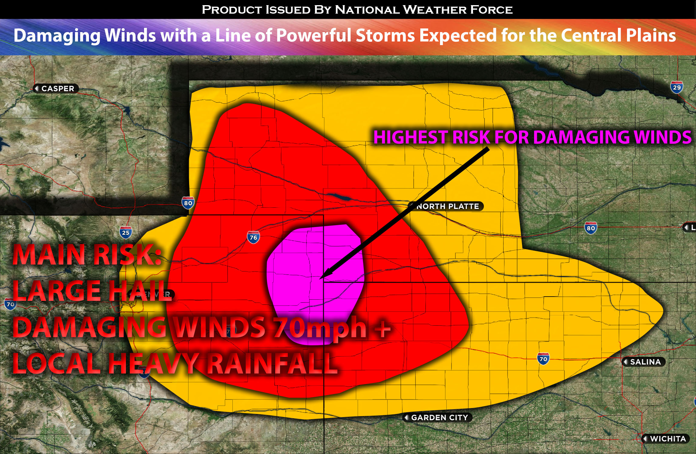
For Colorado, Kansas, and Nebraska:
Initially, these severe thunderstorms will primarily pose a threat of large hail over central and eastern CO and western NE. However, as the storms progress into portions of KS, NE and far eastern CO, they will encounter strong downward instability, increasing the risk of severe gusts. The ingredients will be in place for severe gusts, and there is a considerable probability of significant gusts exceeding 75 mph as they organize into MCS’s (Mesoscale Convective Systems) during the evening over northwest KS.
This severe weather activity will continue eastward into central KS, with the wind hazard gradually reducing into the late-night hours before finally diminishing overnight in the far KS area. A few storms may also linger into NE south.
Here is a graphical representation of where storms are expected to form and move through the impacted regions in the evening/overnight. They’re expected to move from eastern CO and northwestern KS into KS north.
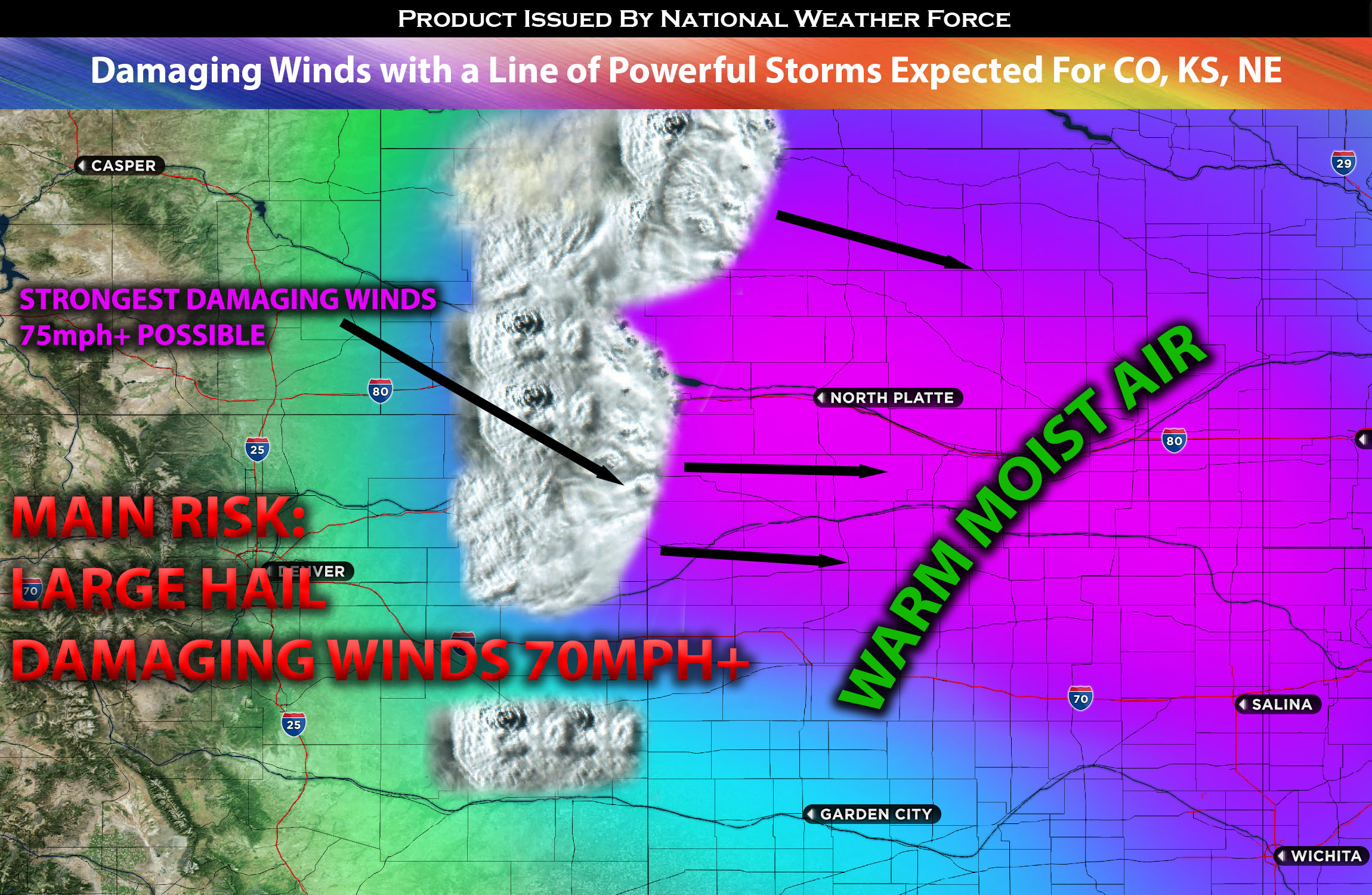
Main risk: large hail, damaging straight-line winds in excess of 75mph+.
Timing: Storms are expected to form around 4-5pm CDT across central and eastern CO and organize with time before becoming an MCS Line into far eastern CO. Finally strengthening with the worse severe weather into KS and potentially all the way through far KS area.
Locations Impacted: northeast CO, east CO, northwest KS, west KS, north KS, portions of west NE and south NE.
Stay tuned for more updates.
Sina⚡⚡
With over a decade of experience in forecasting severe thunderstorms, this individual is a seasoned forecaster and developer. Their expertise in severe weather forecasting and computer science is entirely self-taught, complemented by a foundation in Atmospheric Science from UNCO. They have dedicated their efforts to developing innovative tools that enhance the accuracy of analyzing large hail and tornadoes. As a significant contributor to the National Weather Force, they have played a crucial role in providing accurate and timely information, as well as developing tools to keep those affected well-informed.
NOTE: The alerts and outlooks posted here are customary made to inform. At times, which is often, you will see an alert forecast posted on here that you do not see elsewhere. That is fine, the track record of the main office is very high so maintain to follow an event when posted. These are custom concentrated alerts and outlooks that are created by National Weather Force team of experts.