
 As previously mentioned, a strong to severe line of thunderstorms is anticipated to sweep through northeastern Missouri early Wednesday morning, gradually diminishing as they move southeastward. This residual activity is expected to induce a cap (CINH) over the region, allowing the air to destabilize again before eventually breaking down later in the day. Additionally, the moisture content in the atmosphere is set to intensify, prompting a warm front across both Missouri and Kentucky.
By late Wednesday afternoon, the temperature differential with altitude will noticeably increase for a brief period. Coupled with extremely humid air, mid-level shear, and some ground-level rotation, these conditions could lead to the formation of severe storms. Initially, these storms may produce large hail, before transitioning to damaging winds across Missouri and into western Kentucky. There may also be an embedded isolated tornado risk given some limited low-level shear (spin at lower levels).
These storms, moving in an east-southeast direction across central and eastern Missouri, could potentially initiate as early as 3pm CDT. The storm coverage is predicted to escalate into the evening, before forming a linear pattern across the region and into western Kentucky. However, as these storm lines migrate away from the primary dynamics in the area, they are expected to weaken overnight.
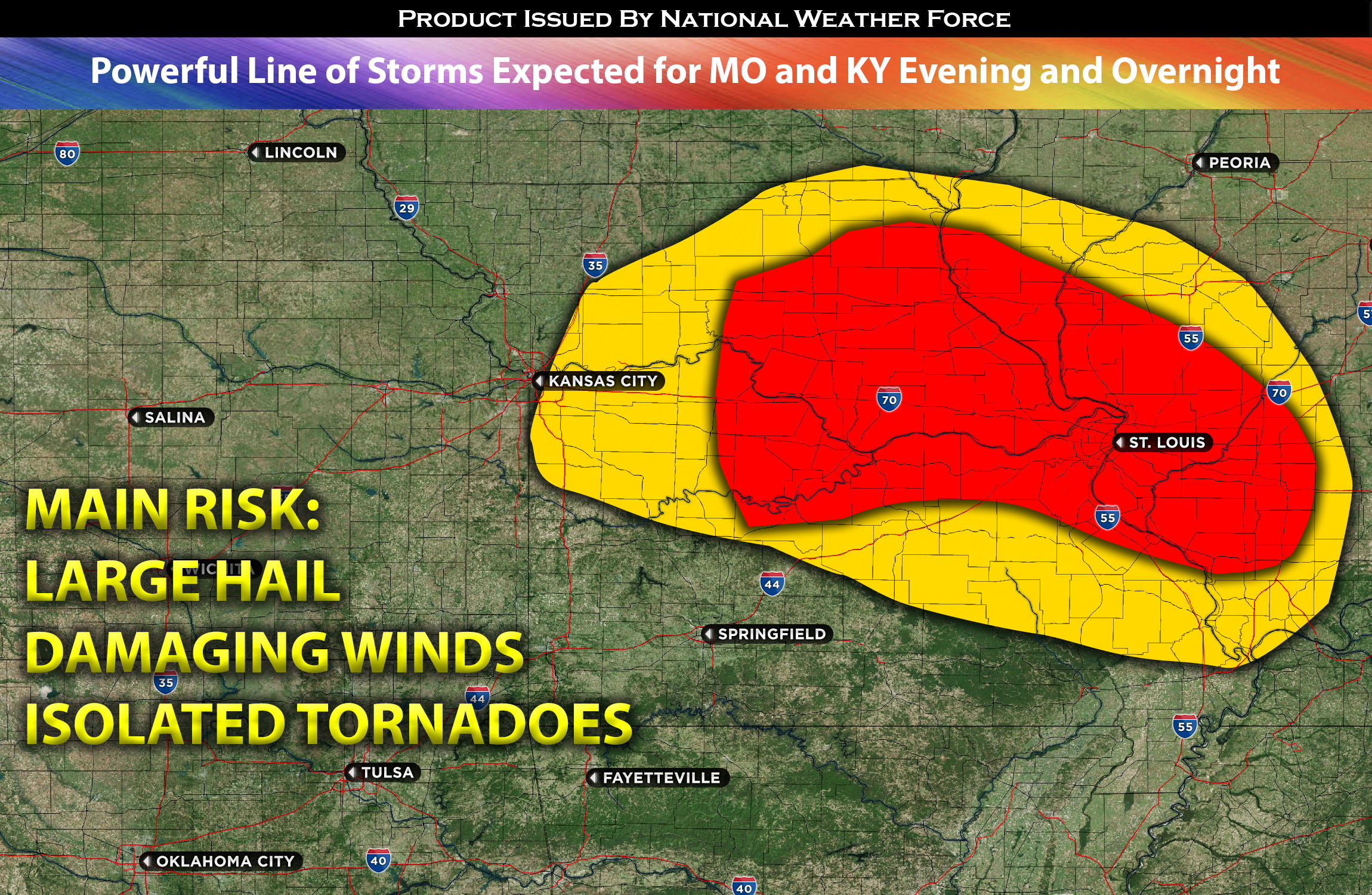
Here is a graphical representation of where storms are expected to form and move through the impacted regions in the evening/overnight. They’re expected to move from eastern and northeastern MO into western KY.
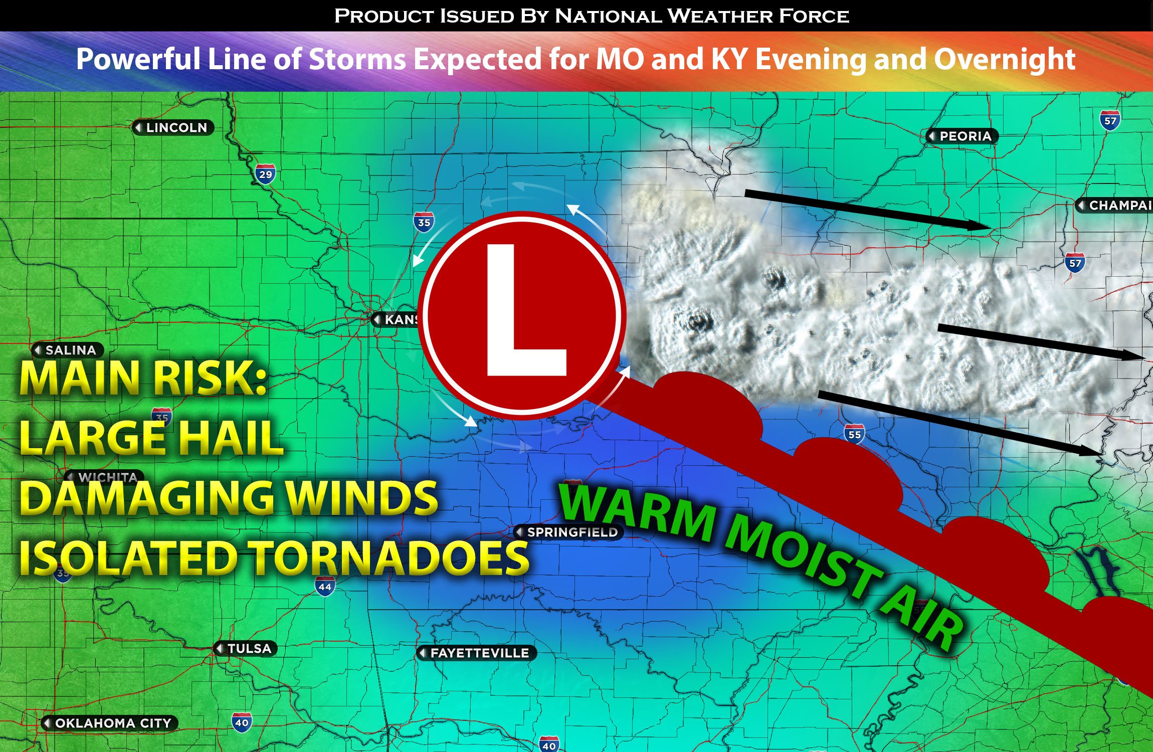
Main risk: large hail, damaging straight-line winds, embedded isolated tornado possible.
Timing: This evening into overnight across MO with the main concentration being eastern MO into western KY.
Locations Impacted: MO most regions except for southwest where the cap expected to remain. The most concentrated area being eastern MO and western KY.
Stay tuned for more updates.