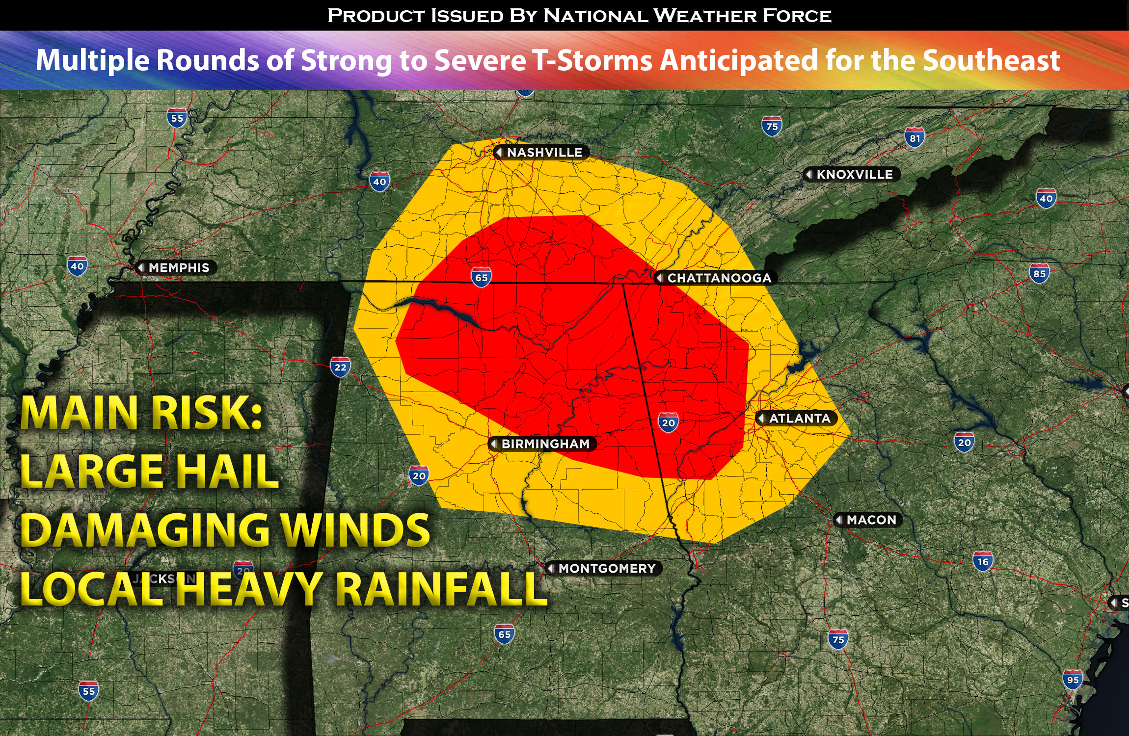
A persistent chain of powerful thunderstorms over northwest Tennessee may be the initial indication of the day’s more significant threats towards the southeast. This is contingent upon the storms enduring long enough for the anticipated air mass to destabilize favorably throughout the day. Therefore, multiple rounds of convective activity are expected across AL and GA area with the more stronger/severe activity being in the evening from north to southeast.
For AL and GA:
Multiple rounds of convective activity expected with more of a strong to severe thunderstorm cluster later in the day through AL and portions of GA northwest. Rich low-level moisture is expected to stretch from the boundary over there to the Gulf Coast. When combined with substantial heating and an expansive troposphere, this should counterbalance relatively moderate change of temperature with height propelling moderate instability (especially downward) range on the warmer (southwestern) side of the boundary. Given that the mid-level shear within the low to mid-levels will be a bit limited, we can expect multicellular clusters to be the primary impact. This may also pave the way for a potential expansion or growth into cold pools which allow for further development across the areas of AL through southeast. The further southwest, the less activity is anticipated given the lack of ingredients.
Main risk: large hail, damaging straight-line winds and local heavy rainfall.
Timing: This late afternoon a few scattered storms with more activity around the evening starting from AL. This continues across AL/GA area with the main concentration being in northern AL. Keep in mind that multiple rounds of convective activity is anticipated for the areas impacted with the most severe being in the evening/overnight before diminishing further to the east of GA.
Locations Impacted: AL northern and eastern parts potentially including the central area; GA northwest and possibly further south into central GA before diminishing in severity. Elsewhere just scattered thunderstorms likely.
Stay tuned for more updates.
Sina⚡⚡
With over a decade of experience in forecasting severe thunderstorms, this individual is a seasoned forecaster and developer. Their expertise in severe weather forecasting and computer science is entirely self-taught, complemented by a foundation in Atmospheric Science from UNCO. They have dedicated their efforts to developing innovative tools that enhance the accuracy of analyzing large hail and tornadoes. As a significant contributor to the National Weather Force, they have played a crucial role in providing accurate and timely information, as well as developing tools to keep those affected well-informed.
NOTE: The alerts and outlooks posted here are customary made to inform. At times, which is often, you will see an alert forecast posted on here that you do not see elsewhere. That is fine, the track record of the main office is very high so maintain to follow an event when posted. These are custom concentrated alerts and outlooks that are created by National Weather Force team of experts.
