
An MCV (Mesoscale Convective Vortex) also known as a low-pressure system with storms spiraling along and around it in short. is anticipated to progress eastward, reaching the Indiana area by this evening or tonight. As the environment continues to destabilize, conditions will grow more favorable for the emergence of scattered storms across the region during the afternoon. Moreover, with the presence of a distinct corridor of beneficial low-level shear coinciding with the northeastern reach of surface-based instability in the southern areas of Illinois and Indiana, we can expect some supercells to form. As these storms mature into the late afternoon and early evening, they’ll likely move eastward into south-central Indiana.
Any particularly intense supercell, given the prevailing wind profile and combination of atmospheric elements, might spawn at least one or two isolated tornadoes. The primary storm activity will center around the central and southern regions near the Illinois-Indiana border, forming a line that persists through Indiana during the evening. Some storm cells may also extend into the northern parts of Kentucky.
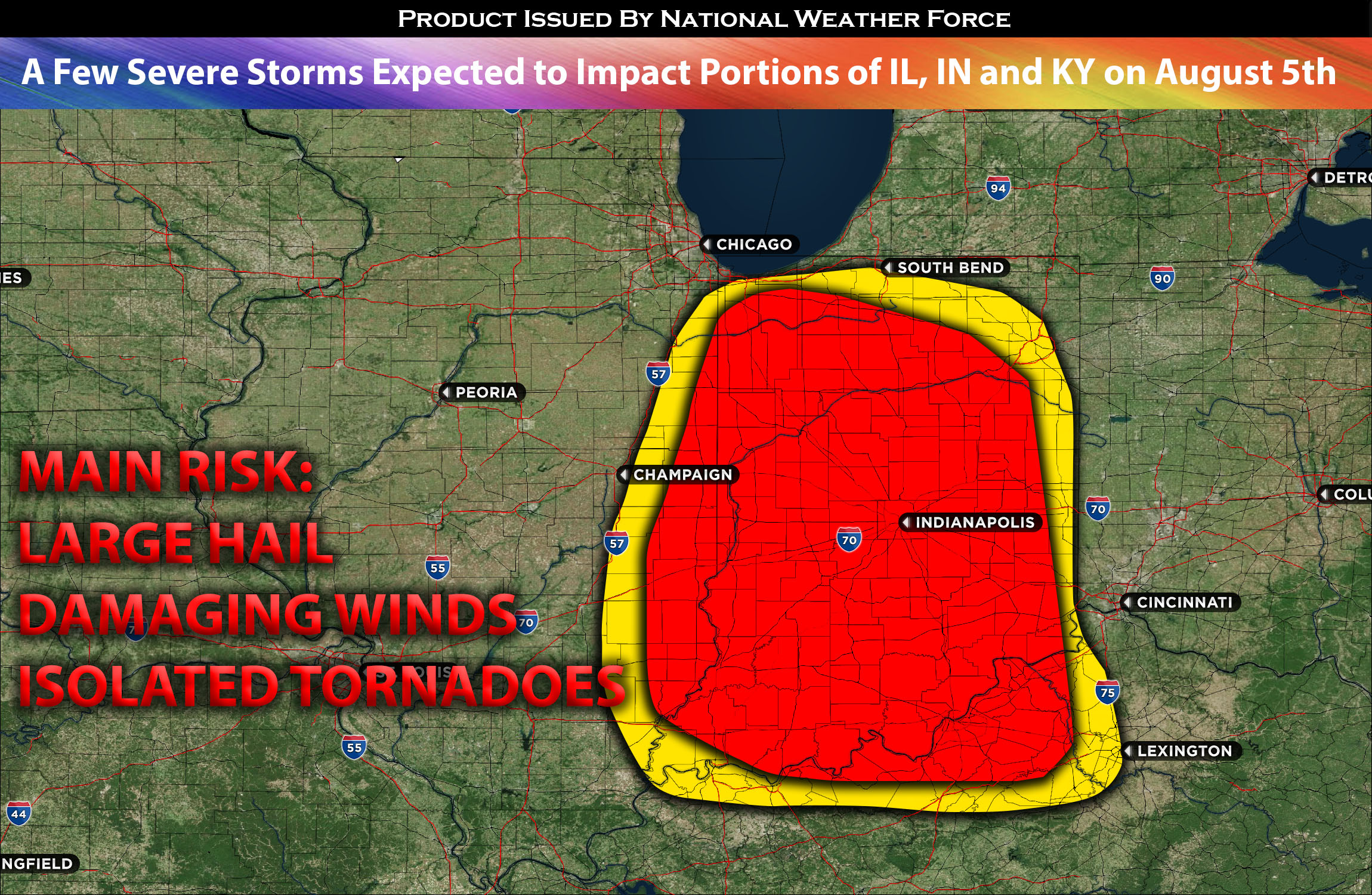
Main risk: large hail, damaging straight-line winds, and isolated tornadoes given the wind profile/low level shear.
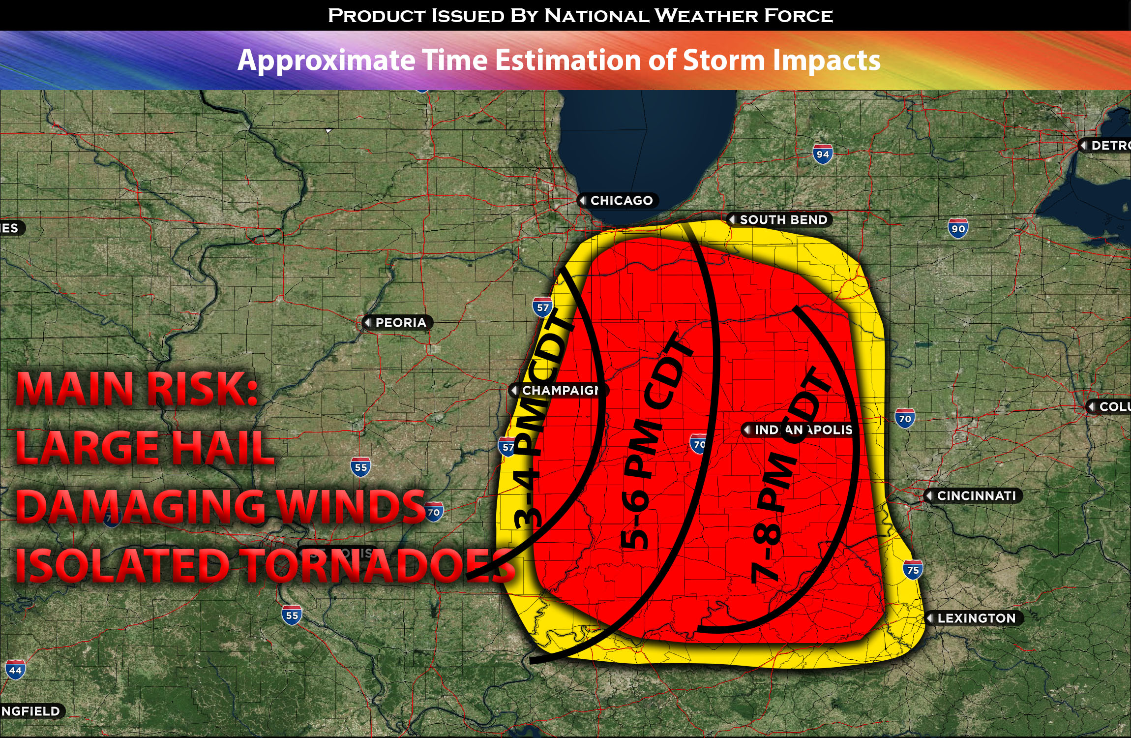
Timing: Storms are expected to continue to form along the border of IL/IN and move throughout the region with more activity across the region through the evening. For more detailed ETA check the graphic below.
Locations Impacted: western, central eastern, southeastern, south IN and portions of northern KY.
Stay tuned for more updates.
Sina⚡⚡
With over a decade of experience in forecasting severe thunderstorms, this individual is a seasoned forecaster and developer. Their expertise in severe weather forecasting and computer science is entirely self-taught, complemented by a foundation in Atmospheric Science from UNCO. They have dedicated their efforts to developing innovative tools that enhance the accuracy of analyzing large hail and tornadoes. As a significant contributor to the National Weather Force, they have played a crucial role in providing accurate and timely information, as well as developing tools to keep those affected well-informed.
NOTE: The alerts and outlooks posted here are customary made to inform. At times, which is often, you will see an alert forecast posted on here that you do not see elsewhere. That is fine, the track record of the main office is very high so maintain to follow an event when posted. These are custom concentrated alerts and outlooks that are created by National Weather Force team of experts.